Ebsdorfergrund
| Ebsdorfergrund | ||
|---|---|---|
|
||
| Coordinates: 50°44′N 08°52′E / 50.733°N 8.867°ECoordinates: 50°44′N 08°52′E / 50.733°N 8.867°E | ||
| Country | Germany | |
| State | Hesse | |
| Admin. region | Gießen | |
| District | Marburg-Biedenkopf | |
| Government | ||
| • Mayor | Andreas Schulz (SPD) | |
| Area | ||
| • Total | 72.89 km2 (28.14 sq mi) | |
| Elevation | 219 m (719 ft) | |
| Population (2015-12-31) | ||
| • Total | 8,900 | |
| • Density | 120/km2 (320/sq mi) | |
| Time zone | CET/CEST (UTC+1/+2) | |
| Postal codes | 35085 | |
| Dialling codes | 06424 | |
| Vehicle registration | MR | |
| Website | www.ebsdorfergrund.de | |
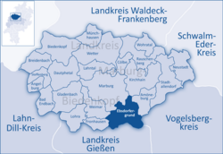
Ebsdorfergrund is a community consisting of 11 villages in the southeast of Marburg-Biedenkopf district in Hesse, Germany.
The community's municipal area extends over the Ebsdorfer Grund in the valley of the Zwester Ohm and the areas around its edges, connecting the Amöneburg Basin with the middle Lahn valley between Marburg and Gießen.
Through the municipal area runs a highway from Fronhausen (Autobahn interchange in Gießen by Bundesstraße B 3) to Kirchhain. Another one joins Marburg with Grünberg.
The old ring railway, the Marburger Kreisbahn, which opened in 1905 and ran through the municipal area to Dreihausen, was shut down in 1972.
In the northwest, Ebsdorfergrund borders on the town of Marburg, in the north on the town of Kirchhain, in the northeast on the town of Amöneburg (all in Marburg-Biedenkopf) and the town of Homberg (Vogelsbergkreis), in the south on the community of Rabenau and the town of Allendorf, in the southwest on the town of Staufenberg (all three in Gießen district), and in the west on the communities of Fronhausen and Weimar (both in Marburg-Biedenkopf).
The community consists of the following centres (Ortsteile):
As of municipal elections held on 26 March 2006, seats on the municipal council are apportioned thus:
The community's municipal coat of arms might be described as: Or, on a three-knolled hill vert a crenellated tower gules, therein the Hessian shield.
...
Wikipedia


