Eatonville, Washington
| Eatonville, Washington | |
|---|---|
| Town | |

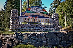
Welcome sign in Eatonville
|
|
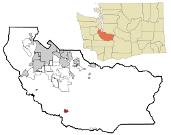
 Location of Eatonville, Washington |
|
| Coordinates: 46°52′6″N 122°16′12″W / 46.86833°N 122.27000°WCoordinates: 46°52′6″N 122°16′12″W / 46.86833°N 122.27000°W | |
| Country | United States |
| State | Washington |
| County | Pierce |
| Area | |
| • Total | 1.84 sq mi (4.77 km2) |
| • Land | 1.82 sq mi (4.71 km2) |
| • Water | 0.02 sq mi (0.05 km2) |
| Elevation | 801 ft (244 m) |
| Population (2010) | |
| • Total | 2,758 |
| • Estimate (2015) | 2,900 |
| • Density | 1,515.4/sq mi (585.1/km2) |
| Time zone | Pacific (PST) (UTC-8) |
| • Summer (DST) | PDT (UTC-7) |
| ZIP code | 98328 |
| Area code(s) | 360 |
| FIPS code | 53-20260 |
| GNIS feature ID | 1519161 |
| Website | eatonville-wa.gov |
Eatonville is a town in Pierce County, Washington, United States. It is 51 mi (82 km) south of Seattle. The population was 2,758 at the 2010 census.
For centuries, Nisqually people roamed the rivers and streams of the Eatonville area. Leschi, one of the main leaders of Nisqually was born in this area in 1808.
Indian Henry, another Nisqually, was one of those who, in 1889, guided the town's founder, Thomas C. Van Eaton, from Mashell Prairie to the present site of Eatonville. It is said that upon arrival, Henry declared, "This good place. Not much snow."
Area settlers and Nisqually were in need of goods, which "T.C." provided at his trading post. Supplies were carried by his stage from Spanaway over a rough trail through dense forest. In 1891, the settlers built the town's first school, which is still in use.
For years Eatonville was a waypoint for visitors to Mount Rainier. In 1902, the Tacoma Eastern Railroad arrived, providing freight and passenger service and a vital link to Tacoma. Soon after the railroad's arrival, several small mills sprang up in the vicinity. In the 1970s, the Wildlife park of Northwest Trek was opened and it remains to be one of the most popular tourist attractions in the area, other than Mount Rainier itself.
Eatonville was officially incorporated on October 28, 1909, after the Eatonville Lumber Company brought in more people to work in its mill. The mill's closure in 1954 was a blow to the town, but community spirit and good schools have kept Eatonville alive and growing.
History found at EatonvilleChamber.com, and comes directly from a Pierce County Landmark marker found at the intersection of Mashell Ave and Center St. in Eatonville, Washington.
According to the United States Census Bureau, the town has a total area of 1.84 square miles (4.77 km2), of which, 1.82 square miles (4.71 km2) is land and 0.02 square miles (0.05 km2) is water.
This region experiences warm (but not hot) and dry summers, with no average monthly temperatures above 71.6 F (22 C). According to the Köppen Climate Classification system, Eatonville has a warm-summer Mediterranean climate, abbreviated "Csb" on climate maps.
...
Wikipedia
