Eatonia (Elvie Smith) Municipal Airport
| Eatonia (Elvie Smith) Municipal Airport | |||||||||||
|---|---|---|---|---|---|---|---|---|---|---|---|
| Summary | |||||||||||
| Airport type | Public | ||||||||||
| Owner | Town of Eatonia | ||||||||||
| Operator | Town of Eatonia | ||||||||||
| Serves | Eatonia | ||||||||||
| Location | Eatonia, Saskatchewan | ||||||||||
| Time zone | CST (UTC−06:00) | ||||||||||
| Elevation AMSL | 2,365 ft / 721 m | ||||||||||
| Coordinates | 51°13′10″N 109°23′32″W / 51.21944°N 109.39222°WCoordinates: 51°13′10″N 109°23′32″W / 51.21944°N 109.39222°W | ||||||||||
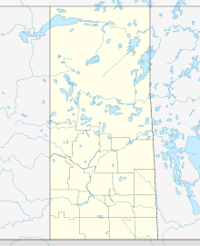
| Map | |||||||||||
| Location in Saskatchewan | |||||||||||
| Runways | |||||||||||
|
|||||||||||
|
Source: Canada Flight Supplement
|
|||||||||||
Eatonia (Elvie Smith) Municipal Airport, (TC LID: CJG2), is a registered aerodrome located adjacent to Eatonia, Saskatchewan, Canada. It is named for the local community and Elvie L. Smith, former President and Chairman of Pratt and Whitney Canada.
The airport has one large hangar type building just south of Eatonia Heritage Park (former railway siding). The runway is a turf (grass) strip with no markings. The airport handles small propeller aircraft only.
...
Wikipedia


