Eastshore, Kansas
| Eastshore, Kansas | |
|---|---|
| Unincorporated community | |
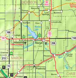
 KDOT map of Marion County (legend) |
|
| Coordinates: 38°22′55″N 097°04′26″W / 38.38194°N 97.07389°WCoordinates: 38°22′55″N 097°04′26″W / 38.38194°N 97.07389°W | |
| Country | United States |
| State | Kansas |
| County | Marion |
| Township | Gale |
| Platted | 1969 |
| Elevation | 1,381 ft (421 m) |
| Time zone | CST (UTC-6) |
| • Summer (DST) | CDT (UTC-5) |
| Area code | 620 |
| FIPS code | 20-19700 |
| GNIS ID | 0484811 |
|
|
|
Eastshore is an unincorporated community in Marion County, Kansas, United States. The community name comes from it being near the east shore of the Marion Reservoir.
For many millennia, the Great Plains of North America was inhabited by nomadic Native Americans. From the 16th century to 18th century, the Kingdom of France claimed ownership of large parts of North America. In 1762, after the French and Indian War, France secretly ceded New France to Spain, per the Treaty of Fontainebleau.
In 1802, Spain returned most of the land to France. In 1803, most of the land for modern day Kansas was acquired by the United States from France as part of the 828,000 square mile Louisiana Purchase for 2.83 cents per acre.
In 1806, Zebulon Pike led the Pike expedition westward from St Louis, Missouri, of which part of their journey followed the Cottonwood River through Marion County near the current cities of Florence, Marion, Durham, and the community of Eastshore.
...
Wikipedia


