Easton, Washington
| Easton, Washington | |
|---|---|
| CDP | |

Easton as seen from the west side
|
|
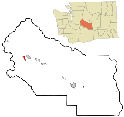
 Location of Easton, Washington |
|
| Coordinates: 47°14′18″N 121°10′42″W / 47.23833°N 121.17833°WCoordinates: 47°14′18″N 121°10′42″W / 47.23833°N 121.17833°W | |
| Country | United States |
| State | Washington |
| County | Kittitas |
| Area | |
| • Total | 1.7 sq mi (4.4 km2) |
| • Land | 1.7 sq mi (4.4 km2) |
| • Water | 0.0 sq mi (0.0 km2) |
| Elevation | 2,169 ft (661 m) |
| Population (2010) | |
| • Total | 478 |
| • Density | 227.3/sq mi (87.8/km2) |
| Time zone | Pacific (PST) (UTC-8) |
| • Summer (DST) | PDT (UTC-7) |
| ZIP code | 98925 |
| Area code(s) | 509 |
| FIPS code | 53-19700 |
| GNIS feature ID | 1519151 |
Easton is a census-designated place (CDP) in Kittitas County, Washington, United States. The population was 478 at the 2010 census.
Easton was platted in 1902. It was given its name by the Northern Pacific Railway due its location near the east end of the Stampede Tunnel.
Easton is located at 47°14′18″N 121°10′42″W / 47.23833°N 121.17833°W (47.238368, -121.178327).
According to the United States Census Bureau, the CDP has a total area of 1.7 square miles (4.4 km²), all of it land.
This region experiences warm (but not hot) and dry summers, with no average monthly temperatures above 71.6 °F. According to the Köppen Climate Classification system, Easton has a warm-summer Mediterranean climate, abbreviated "Csb" on climate maps.
As of the census of 2000, there were 383 people, 151 households, and 104 families residing in the CDP. The population density was 227.3 people per square mile (88.0/km²). There were 228 housing units at an average density of 135.3/sq mi (52.4/km²). The racial makeup of the CDP was 91.91% White, 0.78% Native American, 6.53% from other races, and 0.78% from two or more races. Hispanic or Latino of any race were 9.14% of the population.
...
Wikipedia
