Eastgate, Washington
| Eastgate, Washington | |
|---|---|
| Neighborhood | |

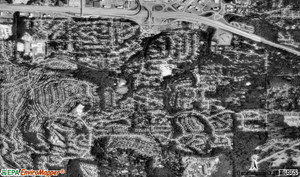
Aerial View of Eastgate
|
|
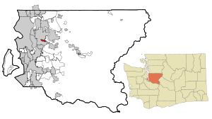
 Location of Eastgate, Washington |
|
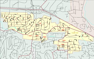
 Map of Eastgate, Washington |
|
| Coordinates: 47°34′19″N 122°08′19″W / 47.57194°N 122.13861°WCoordinates: 47°34′19″N 122°08′19″W / 47.57194°N 122.13861°W | |
| Country | United States |
| State | Washington |
| County | King |
| City | Bellevue |
| Government | |
| • Type | Annexed in June, 2012 |
| Area | |
| • Total | 1.2 sq mi (3.0 km2) |
| • Land | 1.2 sq mi (3.0 km2) |
| • Water | 0 sq mi (0 km2) |
| Elevation | 400 ft (122 m) |
| Population (2010 Census) | |
| • Total | 4,958 |
| • Density | 3,617/sq mi (1,396.7/km2) |
| Time zone | Pacific (UTC−8) |
| • Summer (DST) | Pacific (UTC−7) |
| ZIP code | 98006 |
| Area code(s) | 425 |
| FIPS code | 53-19420 |
| GNIS feature ID | 1512174 |
Eastgate is a recently annexed neighborhood of Bellevue, Washington, United States. The population was 4,958 at the 2010 census.
Based on per capita income, one of the more reliable measures of affluence, Eastgate ranked 38th of 522 areas in the state of Washington to be ranked.
Eastgate is located at 47°34′19″N 122°8′19″W / 47.57194°N 122.13861°W (47.572005, -122.138509) and is a residential neighborhood of Bellevue.
Eastgate is located south of exit 11-A along I-90, which runs east-west along Eastgate's north side. Issaquah is to the east along I-90, and I-405 is a short distance to the west. Much of Eastgate is on the northwest flank of Cougar Mountain. Immediately to the west is Factoria. Immediately to the south is Somerset. To the north is the I-90 Corridor. According to the United States Census Bureau, the CDP has a total area of 1.3 square miles (3.3 km²), all of it land.
Eastgate is nearly completely residential. Eastgate lies within the boundaries of the Bellevue and Issaquah School Districts.
...
Wikipedia
