Eastern Isles
| Site of Special Scientific Interest | |

View of a portion of the Eastern Isles
|
|
| Area of Search | Cornwall |
|---|---|
| Grid reference | SV947145 |
| Coordinates | 49°57′06″N 6°15′24″W / 49.9517°N 6.2567°WCoordinates: 49°57′06″N 6°15′24″W / 49.9517°N 6.2567°W |
| Interest | Biological |
| Area | 83.8 hectares (0.838 km2; 0.324 sq mi) |
| Notification | 1971 |
| Natural England website | |
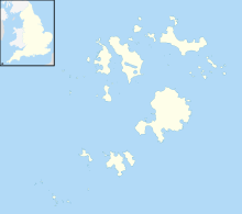
The Eastern Isles (Cornish: Enesow Goonhyli, islands of the salt water downs) are a group of twelve small uninhabited islands within the Isles of Scilly Area of Outstanding Natural Beauty, part of the Scilly Heritage Coast and a Site of Special Scientific Interest (SSSI) first designated in 1971 for its flora and fauna. They have a long period of occupation from the Bronze Age with cairns and entrance graves through to Iron Age field systems and a Roman shrine on Nornour. Before the 19th century, the islands were known by their Cornish name, which had also become the name of the largest island in the group after the submergence of the connecting lands.
The islands are located to the south–east of St Martin’s, and are within the Isles of Scilly Area of Outstanding Natural Beauty and part of the Scilly Heritage Coast.
The Isles are not as exposed to gales as the Western Rocks and consequently the soils do not receive so much salt spray, and remnant habitats such as coastal grassland and maritime heath have survived the inundation of the sea. If the practice of summer grazing had continued there would be even more grassland instead of the dense bramble which has smothered some of the small growing plants.
The islands by area are:
The underlying rock is coarse grained Hercynian granite topped by wind–blown sand. Some of the islands are linked with boulder ridges and sandy bars and at low tide can be viewed as one island. During the Roman occupation of England and Wales the area was a low–lying plain between St Mary's and St Martins and the present Eastern Isles small hills. The Isles of Scilly are a Geological Conservation Review (GCR) site for the largest assemblage of tied islands outside of Orkney and Shetland. Four islands represent the different stages in the linking of islands by a sandy bar or tombola and they are Teän (not part of the Eastern Isles) which is to the north–west, between St Martin’s and Tresco; and Great Arthur, Great Ganinick and Little Ganinick which are to the south–east of St Martin's.
...
Wikipedia

