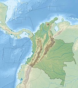
Eastern Hills, Bogotá
| Eastern Hills, Bogotá | |
|---|---|
| Cerros Orientales de Bogotá | |

View of the Eastern Hills, from Salitre
|
|
| Highest point | |
| Elevation | 2,600–3,550 m (8,530–11,650 ft) |
| Prominence | 950 m (3,120 ft) |
| Listing |
Guadalupe Hill – 3,317 m (10,883 ft) Monserrate – 3,152 m (10,341 ft) Aguanoso, Pico del Águila, El Cable, El Chicó, El Chiscal, La Laguna, Pan de Azúcar, La Teta |
| Coordinates | 4°36′21″N 74°02′23″W / 4.60583°N 74.03972°WCoordinates: 4°36′21″N 74°02′23″W / 4.60583°N 74.03972°W |
| Dimensions | |
| Length | 52 km (32 mi) |
| Width | 0.4–8 km (0.25–4.97 mi) |
| Area | 136.3 km2 (52.6 sq mi) |
| Geography | |
| Country |
|
| State |
|
| Settlements | |
| Parent range |
Altiplano Cundiboyacense Eastern Ranges, Andes |
| Geology | |
| Orogeny | Andean |
| Age of rock | Cretaceous-Holocene |
| Mountain type | Fold and thrust belt |
| Type of rock | Sandstones, shales & conglomerates |
| Climbing | |
| First ascent | Pre-Columbian era |
| Access | Roads: Bogotá – La Calera road Autopista Bogotá – Villavicencio Main trails: Pilgrimage trail to Monserrate Las Delicias Trail Las Moyas Trail La Vieja Trail Cable car Candelaria–Monserrate |
|
La Calera – 2,726 metres (8,944 ft)
|
||||||||||||||||||||||||||||||||||||||||||||||||||||||||||||
|---|---|---|---|---|---|---|---|---|---|---|---|---|---|---|---|---|---|---|---|---|---|---|---|---|---|---|---|---|---|---|---|---|---|---|---|---|---|---|---|---|---|---|---|---|---|---|---|---|---|---|---|---|---|---|---|---|---|---|---|---|
| Climate chart () | ||||||||||||||||||||||||||||||||||||||||||||||||||||||||||||
|
||||||||||||||||||||||||||||||||||||||||||||||||||||||||||||
|
||||||||||||||||||||||||||||||||||||||||||||||||||||||||||||
| J | F | M | A | M | J | J | A | S | O | N | D |
|
36
19
6
|
53
19
7
|
70
19
8
|
115
18
9
|
102
18
9
|
79
17
9
|
59
17
8
|
52
17
8
|
58
18
8
|
124
18
8
|
112
18
8
|
58
18
7
|
| Average max. and min. temperatures in °C | |||||||||||
| Precipitation totals in mm | |||||||||||
| Source: Climate-data.org – La Calera | |||||||||||
| Imperial conversion | |||||||||||
|---|---|---|---|---|---|---|---|---|---|---|---|
| J | F | M | A | M | J | J | A | S | O | N | D |
|
1.4
66
43
|
2.1
66
44
|
2.8
66
46
|
4.5
65
47
|
Wikipedia
...
| |||||||

