East Ryde, New South Wales
|
East Ryde Sydney, New South Wales |
|||||||||||||||
|---|---|---|---|---|---|---|---|---|---|---|---|---|---|---|---|

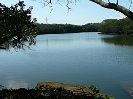
Lane Cove River where it passes East Ryde
|
|||||||||||||||
| Population | 2,337 (2011 census) | ||||||||||||||
| Postcode(s) | 2113 | ||||||||||||||
| Location | 12 km (7 mi) NW of Sydney CBD | ||||||||||||||
| LGA(s) | City of Ryde | ||||||||||||||
| State electorate(s) | Lane Cove | ||||||||||||||
| Federal Division(s) | Bennelong | ||||||||||||||
|
|||||||||||||||
East Ryde is a suburb in the Northern Suburbs of Sydney, in the state of New South Wales, Australia. East Ryde is located 12 kilometres north-west of the Sydney central business district, in the local government area of the City of Ryde. East Ryde sits on the western bank of the Lane Cove River. East Ryde shares the postcode of 2113 with adjacent suburb of North Ryde.
East Ryde is a relatively small, quiet suburb surrounded by bushland and water on all but one side. The majority of East Ryde is located on top of a ridge, a locality known as the Dress Circle Estate. The areas of East Ryde that are at the banks of the Lane Cove River overlook the mangrove wetlands and are characterised by large, modern homes (mainly along Pittwater Road).
The entire area was once turpentine-ironbark forest. During the late 1950s this area was used as the council rubbish dump, before the whole area was re-levelled from the landfill and developed into what is now East Ryde. One main street in the East Ryde suburb, is Cilento Crescent. The area that is now East Ryde was originally known as the 'North Ryde Dress Circle Estate', as it was part of North Ryde before forging its own identity as a suburb.
East Ryde is bounded by Cressy Road, Coxs Road, the Lane Cove River, and Strangers and Buffalo creeks. It was originally part of the Field of Mars Common. This was an area set aside by Governor King in 1804 for breeding stock owned by the early settlers whose allotments were inadequate to sustain their sheep and cattle. Because of its size and rugged character however, the common became infamous as a haven for escaped convicts and robbers. As early as 1856 there were proposals to sell the Field of Mars Common to raise finance for much needed infrastructure, but it was not until 1874 that the Field of Mars Common Resumption Act was passed in the New South Wales parliament. The first land sale of the new subdivision was held in September 1885 and included lots around Kittys Creek and today's East Ryde, though at this time East Ryde did not have a distinctive suburb name – it was part of North Ryde. An early proposal to link the released land to other parts of Sydney involved a tramway to the Field of Mars. In 1884 it was proposed that the tram would run through Balmain and Gladesville, crossing Strangers Creek where a bridge would be built. The tramway would traverse the common on its eastern side, probably along Pittwater Road, and then proceed north. More than 16 years later, on the same day as the opening of the De Burghs Bridge across the Lane Cove River, the Minister for Works proceeded to Gladesville to turn the first sod of the Field of Mars tramway – a tramway that was never built. In 1925 the finance committee of the New South Wales government approved the construction of a railway line between Eastwood and St Leonards. Housing developments appeared along the proposed route. One of these was on a hill near a proposed station at the eastern corner of today's Macquarie Hospital grounds. Because of its elevated position it was called the Dress Circle Estate. This estate was roughly two-thirds of the modern suburb of East Ryde. The 1926 subdivision plan clearly shows the influence that the promised railway had on this development. In larger typeface than 'The Dress Circle Estate' are the words 'Eastwood–St Leonards New railway' - "60 choice elevated lots overlooking the beautiful Lane Cove River... close to a proposed station on the new electric railway from Eastwood to St Leonards". There were two roads indicated – Twin Road and Mary Avenue. There was confidence that the railway would go ahead because it had been a passed by the State Parliamentary Works Committee. In 1929 the estate was extended with an addition called The Hill Top Estate. However, in the same year the government cancelled the proposed railway. Development of the estate ceased after only one house had been built.
...
Wikipedia
