East Glastonbury, Connecticut
| Glastonbury, Connecticut | ||
|---|---|---|
| Town | ||

First Church of Christ
|
||
|
||
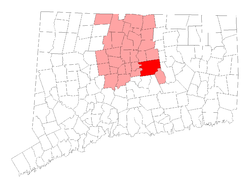
 Location of Glastonbury in Hartford County, Connecticut |
||
| Coordinates: 41°41′13″N 72°32′41″W / 41.68694°N 72.54472°WCoordinates: 41°41′13″N 72°32′41″W / 41.68694°N 72.54472°W | ||
| Country | United States | |
| State | Connecticut | |
| NECTA | Hartford | |
| County | Hartford | |
| Region | Capitol Region | |
| Settled | 1636 | |
| Incorporated | 1693 | |
| Government | ||
| • Type | Council-manager | |
| • Town manager | Richard J. Johnson | |
| • Town council | Susan Karp, Chm. Whit Osgood, Vice Chm. Carol Hemlock Ahlschlager Stewart Beckett, III Kurt P. Cavanaugh Marti Curtiss Timothy P. Coon Bob Zalungo Michele Jacklin |
|
| Area | ||
| • Total | 52.2 sq mi (135.2 km2) | |
| • Land | 51.3 sq mi (132.8 km2) | |
| • Water | 0.9 sq mi (2.4 km2) | |
| Elevation | 417 ft (127 m) | |
| Population (2010) | ||
| • Total | 34,427 | |
| • Density | 660/sq mi (250/km2) | |
| Time zone | Eastern (UTC-5) | |
| • Summer (DST) | Eastern (UTC-4) | |
| ZIP code | 06025, 06033, 06073 | |
| Area code(s) | 860 | |
| FIPS code | 09-31240 | |
| GNIS feature ID | 0213432 | |
| Website | www |
|
Glastonbury is a town in Hartford County, Connecticut, United States, formally founded in 1693 with settlers first arriving in 1636. The town was named after Glastonbury in Somerset, England. Glastonbury is located on the banks of the Connecticut River, 7 miles (11 km) southeast of Hartford. The town center is defined by the U.S. Census Bureau as a census-designated place (CDP). The population was 34,427 at the 2010 census.
In 2013, the South Glastonbury zip code, 06073, was ranked the 11th wealthiest zip code in Connecticut. The town also has the Crystal Ridge neighborhood, which is estimated to be the wealthiest neighborhood in the Greater Hartford area.
In 1636, thirty families were settled in Pyaug, a tract of land belonging to Wethersfield on the eastern bank of the Connecticut River, bought from the Native American chief Sowheag for 12 yards (11 m) of trading cloth. In 1672, Wethersfield and Hartford were granted permission by the General Court to extend the boundary line of Pyaug 5 miles (8 km) to the east. By 1690, residents of Pyaug had gained permission from Wethersfield to become a separate town and, in 1693, the town of Glassenbury was created.
The ties have not been completely broken: the oldest continuously operating ferry in the United States still runs between South Glastonbury and Rocky Hill, also then part of Wethersfield, as it did as far back as 1655. One result of being split off from Wethersfield was that the town was built along a main road, rather than around the large green that anchors most New England towns. After part of New London Turnpike was realigned to eliminate the rotary in the middle of town during the mid-20th century, a small green was established there.
...
Wikipedia

