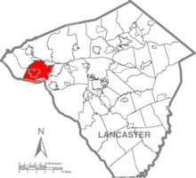
East Donegal Township, Lancaster County, Pennsylvania
| East Donegal Township, Pennsylvania | |
|---|---|
| Township | |

|
|
 Map of Lancaster County, Pennsylvania highlighting East Donegal Township |
|
 Map of Lancaster County, Pennsylvania |
|
| Country | United States |
| State | Pennsylvania |
| County | Lancaster |
| Settled | 1716 |
| Incorporated | 1838 |
| Government | |
| • Type | Board of Supervisors |
| Area | |
| • Total | 24.1 sq mi (62 km2) |
| • Land | 21.8 sq mi (56 km2) |
| • Water | 2.3 sq mi (6 km2) |
| Population (2010) | |
| • Total | 7,755 |
| • Density | 247.7/sq mi (95.6/km2) |
| Time zone | Eastern (EST) (UTC-5) |
| • Summer (DST) | EDT (UTC-4) |
| Area code(s) | 717 |
East Donegal Township is a township in northwestern Lancaster County, Pennsylvania, United States. At the 2010 census the population was 7,755.
It is named after County Donegal, Ireland. The original township of Donegal was organized by the court of Chester County in 1722, and was one of the two townships which composed Lancaster County at the time of its erection in 1729. On the 24th of June, 1838, a division was effected, whereby the old township was constituted into two townships, to be separately and distinctly recognized as East Donegal and West Donegal.
The settlers of East Donegal were of Scotts-Irish descent and were primarily farmers who were drawn to the area by the rich soils and plentiful streams. Thus the abundant produce provided by the land was able to be made into flour by the many mills which sprang up in the area.
Early settlers, Arthur Patterson and others, organized a Presbyterian Church at Donegal in 1726, and erected the old church edifice at that time. The first three pastors of it were from Scotland. Bartram Galbraith, grandson of James Galbraith, was Lieutenant for Lancaster County, the first three years of the Revolution, and many members of that family served in various official positions, as also did Alexander Lowrey and several of that family.
The boundaries of the township, as defined at the time of the division, are north by Mount Joy, northeast by Rapho, east by West Hempfield, south by the Susquehanna River, west by Conoy and West Donegal. Along the eastern boundary flow the Little Chiques Creek and Shares Run. The principal settlement in the township is the borough of Marietta. We do not mean to infer that there exists any definite relation between the township and the borough, as the latter has a distinct municipal government apart from any connection with the former, but it occupies land formerly belonging to and located in East Donegal Township.
...
Wikipedia
