Eagle County, Colorado
| Eagle County, Colorado | |
|---|---|
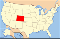
 Location in the U.S. state of Colorado |
|
 Colorado's location in the U.S. |
|
| Founded | February 11, 1883 |
| Named for | Eagle River |
| Seat | Eagle |
| Largest community | Edwards |
| Area | |
| • Total | 1,692 sq mi (4,382 km2) |
| • Land | 1,685 sq mi (4,364 km2) |
| • Water | 7.3 sq mi (19 km2), 0.4% |
| Population (est.) | |
| • (2015) | 53,605 |
| • Density | 31/sq mi (12/km²) |
| Congressional districts | 2nd, 3rd |
| Time zone | Mountain: UTC-7/-6 |
| Website | www |
Eagle County is one of the 64 counties of the U.S. state of Colorado. As of the 2010 census, the population was 52,197. The county seat is the Town of Eagle. The county is named for the Eagle River.
Eagle County comprises the Edwards, CO Micropolitan Statistical Area.
Eagle County was created by the Colorado legislature on February 11, 1883, from portions of Summit County. It was named after the Eagle River, which runs through the county. The county seat was originally set in Red Cliff, Colorado, but was moved to the town of Eagle in 1921.
The Ground Hog Mine, near Red Cliff, produced gold and silver in two vertical veins in 1887. One vein, or "chimney", contained gold in crystalline form, cemented by iron, while the other contained wire gold in the form of "ram's horns". One of these ram's horns is now on display in the Harvard Mineralogical Museum.
According to the U.S. Census Bureau, the county has a total area of 1,692 square miles (4,380 km2), of which 1,685 square miles (4,360 km2) is land and 7.3 square miles (19 km2) (0.4%) is water.
Much of the county is taken up by White River National Forest, and much of the rest is managed by the Bureau of Land Management. Interstate 70 crosses the county from east to west.
...
Wikipedia
