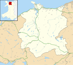
Dwygyfylchi
| Dwygyfylchi | |
|---|---|
 Dwygyfylchi from above Capel Horeb |
|
| Dwygyfylchi shown within Conwy | |
| Population | 4,353 |
| OS grid reference | SH736773 |
| Community | |
| Principal area | |
| Country | Wales |
| Sovereign state | United Kingdom |
| Post town | PENMAENMAWR |
| Postcode district | LL34 |
| Dialling code | 01492 |
| Police | North Wales |
| Fire | North Wales |
| Ambulance | Welsh |
| EU Parliament | Wales |
| UK Parliament | |
| Welsh Assembly | |
Dwygyfylchi ([dʊɨɡəˈvəlχi], approx. duuee-gə-VƏL-khee) is a village in Conwy County Borough, Wales. The community contains the nearby settlement of Penmaenmawr and has a population of 4,353. The electoral ward of Capelulo which includes Dwygyfylchi had a population of 1,485 in 2011.
The name Dwygyfylchi is Welsh for "the meeting of two semicircles", in reference to the nearby promontories of Penmaenbach and Penmaenmawr. The origin of the name Capelulo, the original settlement, lies in its association with Saint Ulo.
Approximately half of Dwygyfylchi forms the most northern tip of the Snowdonia National Park. Half a mile to the south-east of the main village lies Capelulo, which lies at the foot of the picturesque Sychnant Pass, which connects Dwygyfylchi to Conwy. The Pensychnant Conservation Centre and Nature Reserve is nearby. Two headlands separate Dwygyfylchi & Penmaenmawr from its neighbours. Towards the east Penmaenbach divides Dwygyfylchi from the town neighbouring Conwy Morfa and the Conwy Valley leading up to Betws-y-Coed. To the West the larger headland of Penmaenmawr divides them from the town of Llanfairfechan and the wider coastal plain extending to Bangor. To the south an arc of hills and uplands extends east to west from the latter to Penmaen Mawr, beginning with Yr Allt Wen above Dwygyfylchi, Bwlch Sychnant (the old road crosses this pass to Conwy) and Pen-sychnant at Capelulo. The rounded hill of Foel Lys, Gwddw Glas (Green Gorge), Bryn Derwydd and the head of Cwm Graiglwyd and finally Penmaenmawr itself. The coastal plain itself is nearly divided by Trwyn-yr-Wylfa, which also marks the boundary between the "Hen Bentra" or "Old Village" of Dwygyfylchi and Capelulo in the east and Pant-yr-afon and Penmaenan in the west . Finally two small rivers flow through the area. The first and larger, Afon Gyrrach, runs for about 4 miles (6.4 km) from the northern slopes of Tal-y-Fan to the sea near Penmaenbach, passing through Nant Ddaear-y-llwynog ("Fairy Glen") and the old villages of Dwygyfylchi and Capelulo. The second, Afon Pabwyr, runs down from wooded Cwm Graiglwyd then under the town centre, Pant-yr-afon, to the beach.
...
Wikipedia

