Durand, WI
| Durand | |
|---|---|
| City | |

Durand skyline
|
|
| Motto: "On the Banks of the Chippewa" | |
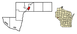
 Location of Durand in Pepin County, Wisconsin. |
|
| Location within the state of Wisconsin | |
| Coordinates: 44°37′43″N 91°57′42″W / 44.62861°N 91.96167°WCoordinates: 44°37′43″N 91°57′42″W / 44.62861°N 91.96167°W | |
| Country | United States |
| State | Wisconsin |
| County | Pepin |
| Government | |
| • Type | City Council |
| • Mayor | Patrick J. Milliren |
| Area | |
| • Total | 1.86 sq mi (4.82 km2) |
| • Land | 1.75 sq mi (4.53 km2) |
| • Water | 0.11 sq mi (0.28 km2) |
| Elevation | 721 ft (219 m) |
| Population (2010) | |
| • Total | 1,931 |
| • Estimate (2016) | 1,846 |
| • Density | 1,103.4/sq mi (426.0/km2) |
| Time zone | Central (CST) (UTC-6) |
| • Summer (DST) | CDT (UTC-5) |
| Standard | 54736 |
| Area code(s) | 715 & 534 |
| FIPS code | 55-21225 |
| GNIS feature ID | 1564195 |
| Website | Official website |
Durand is the county seat of Pepin County, Wisconsin, United States. Situated on the banks of the Chippewa River approximately 15 miles (24 km) from its confluence with the Mississippi River, the city borders the Town of Durand. The population was 1,931 at the 2010 census.
The Durand area was first settled in 1856 when 21-year-old Miles Durand Prindle came up the river in a keel boat named the "Dutch Lady," and took government land on the site of the present city. Originally named Bear Creek, Durand was incorporated on April 12, 1887.
Durand is located at 44°37′42″N 91°57′42″W / 44.62833°N 91.96167°W (44.628512, -91.961718).
According to the United States Census Bureau, the city has a total area of 1.86 square miles (4.82 km2), of which, 1.75 square miles (4.53 km2) is land and 0.11 square miles (0.28 km2) is water.
As of the census of 2010, there were 1,931 people, 838 households, and 509 families residing in the city. The population density was 1,103.4 inhabitants per square mile (426.0/km2). There were 906 housing units at an average density of 517.7 per square mile (199.9/km2). The racial makeup of the city was 98.1% White, 0.2% African American, 0.5% Native American, 0.1% Asian, 0.1% Pacific Islander, 0.3% from other races, and 0.8% from two or more races. Hispanic or Latino of any race were 0.8% of the population.
...
Wikipedia

