Dupo, Illinois
| Dupo | |
| Village | |
| Country | United States |
|---|---|
| State | Illinois |
| County | St. Clair |
| Elevation | 410 ft (125 m) |
| Coordinates | 38°30′57″N 90°12′29″W / 38.51583°N 90.20806°WCoordinates: 38°30′57″N 90°12′29″W / 38.51583°N 90.20806°W |
| Area | 4.42 sq mi (11 km2) |
| - land | 4.42 sq mi (11 km2) |
| - water | 0.00 sq mi (0 km2) |
| Population | 3,933 (2000) |
| Density | 888.6/sq mi (343/km2) |
| Timezone | CST (UTC-6) |
| - summer (DST) | CDT (UTC-5) |
| Postal code | 62239 |
| Area code | 618 |
| FIPS code | 17-21254 |
| GNIS ID | 2398759 |
|
Location in St. Clair County and the state of Illinois.
|
|
|
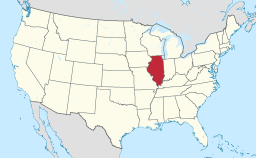
Location of Illinois in the United States
|
|
Dupo is a village in St. Clair County, Illinois, United States. The population was 4,138 at the 2010 census, an increase from 3,933 in 2000. The village was settled in about 1750 and was incorporated in 1876. Its name is derived from Common Fields of Prairie du Pont (French: Bridge Prairie).
Dupo is located at 38°30′57″N 90°12′29″W / 38.51583°N 90.20806°W (38.515702, -90.207992). It is located in the American Bottom floodplain of the Mississippi River.
According to the 2010 census, Dupo has a total area of 4.42 square miles (11.45 km2), all land.
Dupo had its start ca. 1905 when the railroad was extended to that point. The name is an abbreviation of DuPont.
As of the census of 2000, there were 3,933 people, 1,557 households, and 1,063 families residing in the village. The population density was 888.6 people per square mile (342.8/km²). There were 1,668 housing units at an average density of 376.9 per square mile (145.4/km²). The racial makeup of the village was 97.20% White, 1.17% African American, 0.31% Native American, 0.25% Asian, 0.36% from other races, and 0.71% from two or more races. Hispanic or Latino of any race were 0.69% of the population.
...
Wikipedia


