Dunagiri (mountain)
| Dunagiri | |
|---|---|

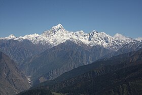
The Dunagiri from Kuari-Pass
|
|
| Highest point | |
| Elevation | 7,066 m (23,182 ft) |
| Prominence | c. 1,200 m (3,900 ft) |
| Coordinates | 30°31′57″N 79°50′02″E / 30.53250°N 79.83389°ECoordinates: 30°31′57″N 79°50′02″E / 30.53250°N 79.83389°E |
| Geography | |
| Location | Uttarakhand, India |
| Parent range | Nanda Devi Group, Garhwal Himalayas |
| Climbing | |
| First ascent | 5 July 1939 by André Roch, F. Steuri, D. Zogg |
| Easiest route | southwest ridge: rock/snow/ice climb |
Dunagiri (7,066 m) is one of the high peaks of the Chamoli District Himalayas in the northern Indian state of Uttarakhand. It lies at the northwest corner of the Sanctuary Wall, a ring of peaks surrounding Nanda Devi and enclosing the Nanda Devi Sanctuary.
Dunagiri was first climbed on 5 July 1939 by the Swiss climbers André Roch, F. Steuri, and D. Zogg, via the southwest ridge. In 1975, Joe Tasker and Dick Renshaw climbed a particularly difficult route on the southeast buttress in a significant milestone for alpine-style climbing. In 1978 the first Australian Himalayan expedition by the Australian National University Mountaineering Club made the fourth ascent via the south-west ridge.Lincoln Hall and Tim Macartney-Snape made the final summit attempt with Macartney-Snape successfully summiting.
Dunagiri peak from Kartik Swami Temple
...
Wikipedia

