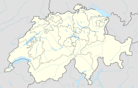
Dufourspitze
| Dufourspitze | |
|---|---|
| French: Pointe Dufour, Italian: Punta Dufour | |

From the peak to the south-east towards Italy, the Dunantspitze in back hides the 18 metres lower Grenzgipfel (English: Border Summit)
|
|
| Highest point | |
| Elevation | 4,634 m (15,203 ft) |
| Prominence | 2,165 m (7,103 ft) ↓ Great St Bernard Pass Ranked 7th in the Alps |
| Isolation | 78.3 km (48.7 mi) → M Blanc de Courmayeur |
| Listing |
Country high point Canton high point Ultra Seven Second Summits |
| Coordinates | 45°56′12.6″N 7°52′01.4″E / 45.936833°N 7.867056°ECoordinates: 45°56′12.6″N 7°52′01.4″E / 45.936833°N 7.867056°E |
| Naming | |
| Native name | Dufourspitze, Höchste Spitze, Gornerhorn |
| Translation | Peak Dufour, Highest Peak, Large Horn |
| Geography | |
| Country | Switzerland |
| Canton | Valais |
| Parent range | Pennine Alps |
| Topo map | Swisstopo 1348 Zermatt |
| Climbing | |
| First ascent | 1 August 1855 by Matthäus and Johannes Zumtaugwald, Ulrich Lauener, Christopher and James Smyth, Charles Hudson, John Birkbeck and Edward Stephenson. |
| Easiest route | rock/snow/ice climb |
The Dufourspitze is the highest peak of Monte Rosa, a huge ice-covered mountain massif in the Alps. Dufourspitze is the highest mountain peak of both Switzerland and the Pennine Alps and is also the second-highest mountain of the Alps and Europe outside the Caucasus. It is located between Switzerland (Canton of Valais) and Italy (Piedmont and Aosta Valley).
Following a long series of attempts beginning in the early nineteenth century, Monte Rosa's summit, then still called Höchste Spitze (English: Highest Peak), was first reached on 1 August, the Swiss National celebration day, in 1855 from Zermatt by a party of eight climbers led by three guides: Matthäus and Johannes Zumtaugwald, Ulrich Lauener, Christopher and James Smyth, Charles Hudson, John Birkbeck and Edward Stephenson.
The peak is distinguished by the name Dufourspitze (in German, lit. Dufour Peak; French: Pointe Dufour, Italian: Punta Dufour). This replaced the former name Höchste Spitze (English: Highest Peak) that was indicated on the Swiss maps before the Federal Council, on January 28, 1863, decided to rename the mountain in honor of Guillaume-Henri Dufour. Dufour was a Swiss engineer, topographer, co-founder of the Red Cross and army general who led the Sonderbund campaign. This decision followed the completion of the Dufour Map, a series of military topographical maps created under the command of Dufour.
...
Wikipedia

