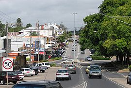
Drouin, Victoria
|
Drouin Victoria |
|||||||||||||
|---|---|---|---|---|---|---|---|---|---|---|---|---|---|

Main street
|
|||||||||||||
| Coordinates | 38°08′0″S 145°51′0″E / 38.13333°S 145.85000°ECoordinates: 38°08′0″S 145°51′0″E / 38.13333°S 145.85000°E | ||||||||||||
| Population | 9,686 (2011 census) | ||||||||||||
| Postcode(s) | 3818 | ||||||||||||
| Location | |||||||||||||
| LGA(s) | Shire of Baw Baw | ||||||||||||
| County | Buln Buln | ||||||||||||
| Parish | Drouin West | ||||||||||||
| State electorate(s) | Narracan | ||||||||||||
| Federal Division(s) | McMillan | ||||||||||||
|
|||||||||||||
Drouin is a town in the West Gippsland region, 90 kilometres (56 mi) east of Melbourne, in the Australian state of Victoria. Its local government area is the Shire of Baw Baw. The town is supposedly named after a Frenchman who invented a chlorination process for the extraction of ore or an Aboriginal word meaning "north wind". New housing developments have accelerated the town's residential growth in recent years. As at the 2011 census, Drouin had a population of 9,686 people.
Settlement in this part of Gippsland was rather delayed due to the dense forest. Pastoral runs were taken up but little developed. In 1867, a coaching station was established on the track into Gippsland at Brandy Creek, about 7 kilometres (4.3 mi) north-east of present Drouin. By the early 1870s, a small settlement had developed and land was being selected in the area.
Meanwhile, contracts had been let for the construction of a railway from Melbourne into Gippsland. Workers' camps were set up along the route which passed to the south of Brandy Creek. There were three camps in the vicinity of Drouin. After the Gippsland Railway opened in 1878, a township was surveyed at Drouin Junction, soon known as Drouin. A post office opened on 5 April 1876 and was renamed Jindivick in 1878. A post office named Drouin Junction opened on 1 January 1877 and was renamed Drouin in 1878. As Drouin developed, Brandy Creek, now called Buln Buln, had declined. When the Buln Buln Shire was formed in 1878, the administrative centre was located in Drouin. The new Tourists' Guide described the township in 1889, showing its substantial development.
Throughout the 1880s, a number of small sawmills operated in the Drouin district, many transporting their timber by tramway to the railway station. In the 1890s, a quarry was opened south-east of Drouin, the stone being carried by tramway to a railway siding east of Drouin. In 1913, this quarry was purchased and operated by the shire.
...
Wikipedia

