Driskill Mountain
| Driskill Mountain | |
|---|---|

Driskill Mountain Summit
|
|
| Highest point | |
| Elevation | 535 ft (163 m) NGVD 29 |
| Prominence | 225 ft (69 m) |
| Listing | U.S. state high point 48th |
| Coordinates | 32°25′29″N 92°53′51″W / 32.4245981°N 92.8973794°WCoordinates: 32°25′29″N 92°53′51″W / 32.4245981°N 92.8973794°W |
| Geography | |
| Climbing | |
| Easiest route | Hike |
Driskill Mountain (also referred to as Mount Driskill) is the highest natural summit in Louisiana, with an elevation of 535 feet (163 m) above sea level. It lies about 5.3 miles (8.5 km) southeast of Bryceland, Louisiana. It is located in the northeastern corner of Sec. 32, T. 17 N., R. 5 W. within Bienville Parish.
Driskill Mountain is a landform created by the erosion of unlithified Paleogene sediment. Its summit consists of nonmarine quartz sands of the Cockfield Formation. These sands overlie shallow marine and coastal clays, silts, and sands of the Cook Mountain Formation, which form the bulk of Driskill Mountain.
James Christopher Driskill, the person for whom Driskill Mountain was named, was born in Henry County, Georgia, on June 27, 1817. In 1840, he married the former Eugenia Irwin Walker. In October 1859, Driskill sold his land in Troup County, Georgia, and moved his family, which by then consisted of his wife, eight boys, and one girl, to Louisiana. By December 1859, Driskill had purchased in Louisiana 324 acres (1.31 km2), which included Driskill Mountain. During the American Civil War, Driskill served in the Home Guard. His eldest son, William B. Driskill, was killed in action at the Battle of the Wilderness in Virginia on May 5, 1864. Another one of his sons, James B. Driskill, disappeared after he had left Louisiana to fight in the Civil War. Except for one son and daughter, Driskill's family remained in Bienville Parish, and his descendents still live in the area.
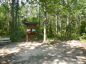
One may walk the trail to the top and sign the logbook located in an army box. A large pile of rocks marks the high point.
...
Wikipedia


