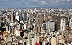
Downtown São Paulo
|
Central Zone of São Paulo Zona Central |
|
|---|---|
 |
|
 Location of Central Zone of São Paulo |
|
| Country |
|
| State |
|
| City |
|
| Subprefectures |
Central Zone
|
| Area | |
| • Total | 8 km2 (3.2 sq mi) |
The Central Zone (Portuguese: Zona Central de São Paulo) is an administrative zone of the city of São Paulo, Brazil.
One of the largest commercial and business districts in South America, the region is administered by the subprefecture of Sé. It is not concurrent, although often confused, with the regions known as Centro Expandido ("Expanded Center"), a broader area used by the city government for urban planning and road space rationing actions and Centro Histórico de São Paulo ("São Paulo Historic Center"), which, as the name implies, includes only the oldest part of the central region.
Officially, the central area is bounded by districts of Municipality Cathedral. However, the social perception of what is called "center of São Paulo" varies and may include other areas of city. Until the creation of the administrative office of the Cathedral, the notion of "center" was equivalent to the region of the former administration regional office, who also included the districts of Brás and Pari, currently covered by an Municipality of Mooca. The concept of a central area of São Paulo, however, is wider depending on the study is done about the region and may include items such as financial centers Paulista Avenue and Berrini.
According to the 2000 census, the total population of the area is 374,002 inhabitants, including the neighborhoods and districts of Sé itself, Bela Vista, Bom Retiro, Cambuci, Consolação, Aclimação, Brás, Liberdade, República and Santa Cecília. It is the least populated administrative region in the city, albeit one with a wider range of public facilities and jobs. The average income in the area is R$ 2335.54, and each year the central area of São Paulo has a rate negative of population growth that reaches 5% per year, according to IBGE and statistics.
...
Wikipedia
