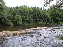
Dore (France)
| Dore | |
|---|---|

upstream of Olliergues
|
|
| Country | France |
| Physical characteristics | |
| Main source | Massif Central |
| River mouth |
Allier 46°0′34″N 3°28′26″E / 46.00944°N 3.47389°ECoordinates: 46°0′34″N 3°28′26″E / 46.00944°N 3.47389°E |
| Length | 141 km (88 mi) |
| Discharge |
|
| Basin features | |
| Progression | Allier→ Loire→ Atlantic Ocean |
| Basin size | 1,523 km2 (588 sq mi) |
The Dore is a 141 km long river in central France in the department of Puy-de-Dôme. It is a right tributary of the Allier. Its source is near the town of Saint-Germain-l'Herm in the Massif Central. The Dore flows generally north, through the following towns: Arlanc, Ambert, Courpière, and Puy-Guillaume. The Dore flows into the Allier 6 km north of Puy-Guillaume.
...
Wikipedia
