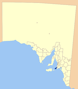
District Council of Yankalilla
|
District Council of Yankalilla South Australia |
|||||||||||||
|---|---|---|---|---|---|---|---|---|---|---|---|---|---|

Location of the District Council of Yankalilla
|
|||||||||||||
| Population | 4,700 (2015 est) | ||||||||||||
| • Density | 6.26/km2 (16.22/sq mi) | ||||||||||||
| Established | 1856 | ||||||||||||
| Area | 750.6 km2 (289.8 sq mi) | ||||||||||||
| Mayor | Glen Rowlands | ||||||||||||
| Council seat | Yankalilla | ||||||||||||
| Region | Fleurieu and Kangaroo Island | ||||||||||||
| State electorate(s) | Finniss | ||||||||||||
| Federal Division(s) | Mayo | ||||||||||||
 |
|||||||||||||
| Website | District Council of Yankalilla | ||||||||||||
|
|||||||||||||
The District Council of Yankalilla is a local government area centred on the town of Yankalilla on the Fleurieu Peninsula in South Australia.
It was created on 23 October 1856, when the District Council of Yankalilla and Myponga was divided into two. It later absorbed two other councils: the District Council of Myponga on 5 January 1888, one of a number of amalgamations mandated under the District Councils Act 1887, and later the District Council of Rapid Bay on 12 May 1932.
The district has a rich history, as one of the earliest South Australian coastal settlements, and a wide range of agricultural activities having taken place. Today the district remains agricultural in nature, supplemented by tourism and forestry.
The Fleurieu Peninsula was originally inhabited by the indigenous Kaurna people, who openly met with the Ramindjeri and other peoples for trade and exchanges. Aboriginal myth credits the formation of the land forms of the Fleurieu Peninsula to the travels of Tjilbruke as he grieved carrying the body of his nephew from the Sturt River to Cape Jervis.
Evidence of Megafauna, including bones attributed to Diprotodon, Maesopus – the giant kangaroo and Thylacoleo – a marsupial lion, were discovered in the 1890s. A Diprotodon leg bone was found in a swamp in the 1890s and conjecture surrounds the possibility that the animals were hunted by local aboriginal groups.
The Fleurieu Peninsula was first mapped by Europeans in 1802 with both the French Nicholas Baudin and the English Matthew Flinders travelling the coastline, with Baudin giving Fleurieu Peninsula its name.
...
Wikipedia
