District Council of Grant
|
District Council of Grant South Australia |
|||||||||||||
|---|---|---|---|---|---|---|---|---|---|---|---|---|---|

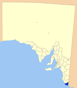
Location of the District Council of Grant
|
|||||||||||||
| Population | 8,235 (2015 est) | ||||||||||||
| • Density | 4.3251/km2 (11.202/sq mi) | ||||||||||||
| Established | 1996 | ||||||||||||
| Area | 1,904 km2 (735.1 sq mi)The District Council of Grant completely surrounds but does not include the City of Mount Gambier. | ||||||||||||
| Mayor | Richard Sage | ||||||||||||
| Council seat | Mount Gambier | ||||||||||||
| Region | Limestone Coast | ||||||||||||
| State electorate(s) | Mount Gambier | ||||||||||||
| Federal Division(s) | Barker | ||||||||||||
 |
|||||||||||||
| Website | District Council of Grant | ||||||||||||
|
|||||||||||||
The District Council of Grant is a local government area located in the Limestone Coast region of South Australia, and is the southernmost council in the state.
The council was formed on 1 July 1996 after the amalgamation of the District Council of Mount Gambier and the District Council of Port MacDonnell, and currently surrounds the City of Mount Gambier. The economy of the district is based on agriculture, forestry and fishing.
The council seat and administration offices are outside the council boundaries in Mount Gambier, while it maintains a branch office in Port MacDonnell.
The council includes the towns and localities of Allendale East, Blackfellows Caves, Canunda, Cape Douglas, Caroline, Carpenter Rocks, Caveton, Compton, Dismal Swamp, Donovans, Eight Mile Creek, German Creek, Kongorong, Mil-Lel, Mingbool, Moorak, Mount Schank, Nene Valley, Pelican Point, Pleasant Park, Port MacDonnell, Racecourse Bay, Square Mile, Tarpeena, Wandilo, Wye and Yahl, and parts of Burrungule, Glenburnie, OB Flat, Suttontown, Tantanoola, Wepar and Worrolong.
...
Wikipedia
