Dickenschied
| Dickenschied | ||
|---|---|---|
|
||
| Coordinates: 49°54′02″N 7°25′12″E / 49.90056°N 7.42000°ECoordinates: 49°54′02″N 7°25′12″E / 49.90056°N 7.42000°E | ||
| Country | Germany | |
| State | Rhineland-Palatinate | |
| District | Rhein-Hunsrück-Kreis | |
| Municipal assoc. | Kirchberg | |
| Government | ||
| • Mayor | Karl-Wilhelm Bender | |
| Area | ||
| • Total | 5.86 km2 (2.26 sq mi) | |
| Elevation | 400 m (1,300 ft) | |
| Population (2015-12-31) | ||
| • Total | 704 | |
| • Density | 120/km2 (310/sq mi) | |
| Time zone | CET/CEST (UTC+1/+2) | |
| Postal codes | 55483 | |
| Dialling codes | 06763 | |
| Vehicle registration | SIM | |
| Website | www |
|
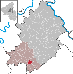
Dickenschied is an Ortsgemeinde – a municipality belonging to a Verbandsgemeinde, a kind of collective municipality – in the Rhein-Hunsrück-Kreis (district) in Rhineland-Palatinate, Germany. It belongs to the Verbandsgemeinde of Kirchberg, whose seat is in the like-named town.
The municipality lies on a ridge in the Hunsrück five kilometres south of Kirchberg. To the east lies the Simmerbach valley, to the west lies the Kyrbach valley and to the south looms a hill region called the Lützelsoon.
The Dickenschied area was settled as early as the New Stone Age, as witnessed by finds in the neighbouring municipalities of Woppenroth and Gemünden. After the Stone Age and the Bronze Age, the Hunsrück’s, and thereby also Dickenschied’s, prehistory and early history was marked by the Celts (600-50 BC), the Romans (50 BC-AD 300) and the Franks (300-1000). Within Dickenschied’s municipal limits, Celtic burying grounds may be found in both the “Bannholz” and “Saliswäldchen” wooded areas. From Roman times, a one-handled jug from the 2nd century has been found, and the old “Roman road” bears witness to this time, too. The outlying, now vanished, village of Werschweiler, to the northeast, was a Frankish centre from about 800. Dickenschied itself is thought to date from no later than 1100, for villages founded in the time of the forest clearing in Merovingian times (600-750) quite commonly have names ending in —schied, —hausen, —rod or —feld. It is believed to have been part of the Frankish Nahegau, a county.
...
Wikipedia


