Derwentside
| Derwentside | |
|---|---|
 Shown within ceremonial County Durham |
|
| Area | |
| • 1974 | 66,944 acres (270.91 km2) |
| Population | |
| • 1973 | 91,460 |
| • 1992 | 87,200 |
| • 2001 | 85,074 |
| History | |
| • Created | 1974 |
| • Abolished | 2009 |
| • Succeeded by | County Durham |
| Status | District |
| ONS code | 20UD |
| Government | Durham County Council |
| • HQ | Consett |
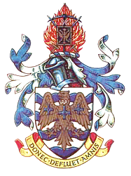
| • Motto | Donec Defluet Amnis (Until the river ceases to flow) |
 |
|
Coordinates: 54°52′01″N 1°45′36″W / 54.867°N 1.760°W
Derwentside was, from 1974 to 2009, a local government district in County Durham, England.
The district took its name from the River Derwent, which made up part of the northern border of the district. Its main towns were Consett and Stanley, with the district council offices on Consett's Medomsley Road. The rest of the district was semi-rural, with numerous former pit villages running into one another.
The district was formed on 1 April 1974 under the Local Government Act 1972, which reorganised local administration throughout England and Wales. The district was a merger of three abolished districts:
Derwentside was one of eight districts into which County Durham was divided in 1974. It was bounded on the east by Chester-le-Street District, to the south-east by the City of Durham and to the south and west by Wear Valley District. To the north the district was bounded by the Metropolitan County of Tyne and Wear and to the north west by Northumberland.
Derwentside's economy was traditionally based on the steel industry and coal mining. With the loss of these industries, the district struggled with unemployment, although European Union funding provided a boost to local businesses and visitor attractions.
...
Wikipedia
