Derry Township, Westmoreland County, Pennsylvania
| Derry Township, Westmoreland County, Pennsylvania |
|
|---|---|
| Township | |

Keystone State Park is in Derry Township
|
|
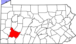
 Map of Westmoreland County, Pennsylvania Highlighting Derry Township |
|
 Map of Pennsylvania highlighting Westmoreland County |
|
| Country | United States |
| State | Pennsylvania |
| County | Westmoreland |
| Settled | 1763 |
| Incorporated | 1775 |
| Named for | Derry |
| Area | |
| • Total | 97.4 sq mi (252 km2) |
| • Land | 95.8 sq mi (248 km2) |
| • Water | 1.6 sq mi (4 km2) |
| Population (2000) | |
| • Total | 14,726 |
| • Density | 153.6/sq mi (59.3/km2) |
| Time zone | Eastern (EST) (UTC-5) |
| • Summer (DST) | EDT (UTC-4) |
| Website | http://www.derrytownship.com |
Derry Township is a township in Westmoreland County, Pennsylvania, in the United States. It surrounds the Borough of Derry, which is a separate municipality. As of the 2000 census, the township population was 14,726.
It was named after the city of Derry by Scotch-Irish settlers.
Keystone State Park was established in 1945.
The Samuel Patterson House was added to the National Register of Historic Places in 1985.
According to the United States Census Bureau, the township has a total area of 97.4 square miles (252 km2), of which, 95.8 square miles (248 km2) of it is land and 1.5 square miles (3.9 km2) of it (1.56%) is water.
The township contains the following communities: Andrico, Andrico No. 2, Atlantic, Bairdstown, Bradenville, Brenizer, Hillside, Loyalhanna, Cokeville Heights, Cooperstown, Kingston, Mannitto Haven, McChesneytown, Millwood, New Derry, Osburn, Pandora, Peanut, Seger, Snydertown, Superior, Torrance, and West Derry.
The villages of Livermore and Cokeville no longer exist, relocated as part of the Conemaugh Dam Flood Control project.
As of the census of 2000, there were 14,726 people, 5,716 households, and 4,201 families residing in the township. The population density was 153.6 people per square mile (59.3/km²). There were 6,200 housing units at an average density of 64.7/sq mi (25.0/km²). The racial makeup of the township was 98.21% White, 1.18% African American, 0.14% Asian, 0.03% Native American, 0.01% Pacific Islander, 0.05% from other races, and 0.37% from two or more races. Hispanic or Latino of any race were 0.47% of the population.
...
Wikipedia
