Del City
| Del City, Oklahoma | |||
|---|---|---|---|
| City | |||
|
|||
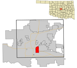
 Location in Oklahoma County and the state of Oklahoma. |
|||
| Location in the United States | |||
| Coordinates: 35°26′34″N 97°26′28″W / 35.44278°N 97.44111°WCoordinates: 35°26′34″N 97°26′28″W / 35.44278°N 97.44111°W | |||
| Country | United States | ||
| State | Oklahoma | ||
| County | Oklahoma County | ||
| Settled | 1940s | ||
| Incorporated | October 9, 1948 | ||
| Founded by | George I. Epperly | ||
| Named for | Delaphene Campbell | ||
| Government | |||
| • Type | Council–manager | ||
| • Mayor | Brian Linley | ||
| • City Manager | Mark Edwards | ||
| Area | |||
| • Total | 7.5 sq mi (19.5 km2) | ||
| • Land | 7.5 sq mi (19.5 km2) | ||
| • Water | 0.06 sq mi (0.0 km2) | ||
| Elevation | 1,201 ft (366 m) | ||
| Population (2010) | |||
| • Total | 21,332 | ||
| • Estimate (2015) | 22,022 | ||
| • Density | 2,935.8/sq mi (1,133.5/km2) | ||
| Time zone | Central (CST) (UTC-6) | ||
| • Summer (DST) | CDT (UTC-5) | ||
| ZIP codes | 73115, 73135 | ||
| Area code(s) | 405 | ||
| FIPS code | 40-19900 | ||
| GNIS feature ID | 1092026 | ||
| Website | City of Del City | ||
Del City is a city in Oklahoma County, Oklahoma, United States, and a part of the Oklahoma City metropolitan area. The population was 21,332 at the 2010 census.
Del City is located near two major interstate highways, both of which connect it to Oklahoma City. Interstate 40 bisects the town from the northwest to southeast, and Interstate 35 lies just a short distance west of the city. The city borders southeast Oklahoma City, Midwest City and Tinker Air Force Base. George Epperly founded the city, which was incorporated by a vote of its residents in 1948. Del City is named after Epperly's eldest daughter Delaphene. Since its incorporation Del City has expanded three times, first by annexing Carter Park in 1954, Midway Village in 1963 and the acquisition of an undeveloped piece of land between the city and Tinker AFB A large area of Del City was significantly impacted by the May 3, 1999 tornado outbreak that passed through the Oklahoma City metro area.
Founded in Boone Township, Oklahoma County as a "bedroom" community, Del City lies three miles (5 km) east of Oklahoma City and one mile (1.6 km) west of Midwest City. At the turn of the 21st century, Del City was a 7.5-square-mile (19 km2) community surrounded on the north, west, and south by Oklahoma City and on the east by Midwest City. Interstate Highway 40 bisects the town from the northwest to southeast. Oklahoma City streets define the boundaries: NE 10th Street on the north; Sooner Road on the east; SE 44th Street on the south; and Bryant Road on the west. Northwestern corner of the city is a mile from the junction of Interstate 35 and Interstate 40, justifying its claim to being "the Crossroads of America."
In the Land Run of 1889, Jordan Pybas and his wife settled in what is current day Del City. Five generations later the family still lives in the house that was completed in 1907. Before 1946 there were only two families living in what would become Del City. Developer George Epperly purchased a wheat field 160 acres (0.65 km2) large at the corner of SE 29th Street and Sunnylane Road in 1946 with a plan to build fifty houses. In 1948 there were 582 homes in Del City, 75% of which were built by George Epperly, Despite opposition, the unincorporated Epperly Heights and its 200 families voted to approve incorporation on October 9, 1948. In February 1959, Del City adopted a charter and a council-manager form of town government. The city was named for Epperly's daughter, Delaphene Campbell.
...
Wikipedia


