Debre Marqos
|
Debre Marqos ደብረ ማርቆስ |
|
|---|---|

A street in Debre Marqos
|
|
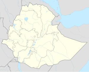
| Location in Ethiopia | |
| Coordinates: 10°20′N 37°43′E / 10.333°N 37.717°E | |
| Country | Ethiopia |
| Region | Amhara Region |
| Zone | Misraq Gojjam Zone |
| Elevation | 2,446 m (8,025 ft) |
| Population (2007) | |
| • Total | 262,497 |
| Time zone | EAT (UTC+3) |
Debre Marqos (also called Mankorar) is a city and woreda in east-central Ethiopia. Located in the Misraq Gojjam Zone of the Amhara Region, it has a latitude and longitude of 10°20′N 37°43′E / 10.333°N 37.717°ECoordinates: 10°20′N 37°43′E / 10.333°N 37.717°E, and an elevation of 2,446 meters. The city is named Debre Marqos after its principal church, which was constructed in 1869 and dedicated to St. Mark. Until the reorganization of the provinces that followed the adoption of the 1995 constitution, this city served as the capital of the province of Gojjam.
Debre Marqos is served by an airport (ICAO code HADM, IATA DBM) with an unpaved runway.
The palace of Negus Tekle Haymanot was remodeled in 1926 by his son Ras Hailu Tekle Haymanot, in the style of European buildings after his tour of Europe in the party of Ras Tefari. By 1935, the town had postal, telegraph, and telephone service.
...
Wikipedia

