De Ronde Venen
| De Ronde Venen | |||
|---|---|---|---|
| Municipality | |||

Vinkeveen town centre
|
|||
|
|||
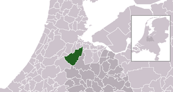
 Location in Utrecht |
|||
| Coordinates: 52°12′N 4°52′E / 52.200°N 4.867°ECoordinates: 52°12′N 4°52′E / 52.200°N 4.867°E | |||
| Country | Netherlands | ||
| Province | Utrecht | ||
| Established | 1 January 1989 | ||
| Government | |||
| • Body | Municipal council | ||
| • Mayor | Maarten Divendal (PvdA) | ||
| Area | |||
| • Total | 116.98 km2 (45.17 sq mi) | ||
| • Land | 100.77 km2 (38.91 sq mi) | ||
| • Water | 16.21 km2 (6.26 sq mi) | ||
| Elevation | −2 m (−7 ft) | ||
| Population (May 2014) | |||
| • Total | 42,654 | ||
| • Density | 423/km2 (1,100/sq mi) | ||
| Time zone | CET (UTC+1) | ||
| • Summer (DST) | CEST (UTC+2) | ||
| Postcode | Parts of 1300, 1400 and 3600 ranges | ||
| Area code | 0294, 0297 | ||
| Website | www |
||
De Ronde Venen (![]() pronunciation ) is a municipality in the Netherlands, in the province of Utrecht. On 1 January 2011, the municipality of Abcoude was amalgamated into De Ronde Venen.
pronunciation ) is a municipality in the Netherlands, in the province of Utrecht. On 1 January 2011, the municipality of Abcoude was amalgamated into De Ronde Venen.
The municipality of De Ronde Venen consists of the villages Abcoude, Amstelhoek, De Hoef, Baambrugge, Mijdrecht, Vinkeveen, Waverveen, and Wilnis, and a number of hamlets, such as Aan de Zuwe, Achterbos, and Stokkelaarsbrug.
Dutch Topographic map of the municipality of De Ronde Venen, June 2015
...
Wikipedia


