Dassel, Minnesota
| Dassel, Minnesota | |
|---|---|
| City | |

Downtown Dassel
|
|
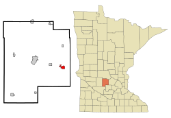
 Location of Dassel within Meeker County, Minnesota |
|
| Coordinates: 45°4′53″N 94°18′37″W / 45.08139°N 94.31028°W | |
| Country | United States |
| State | Minnesota |
| County | Meeker |
| Area | |
| • Total | 1.72 sq mi (4.45 km2) |
| • Land | 1.63 sq mi (4.22 km2) |
| • Water | 0.09 sq mi (0.23 km2) |
| Elevation | 1,089 ft (332 m) |
| Population (2010) | |
| • Total | 1,469 |
| • Estimate (2012) | 1,448 |
| • Density | 901.2/sq mi (348.0/km2) |
| Time zone | Central (CST) (UTC-6) |
| • Summer (DST) | CDT (UTC-5) |
| ZIP code | 55325 |
| Area code(s) | 320 |
| FIPS code | 27-14878 |
| GNIS feature ID | 0642646 |
| Website | www.dassel.com |
Dassel is a city in Meeker County, Minnesota, United States. The population was 1,469 at the 2010 census.
Dassel was platted in 1869, and named for Bernard Dassel, a railroad official. A post office has been in operation at Dassel since 1869. Dassel was incorporated in 1878.
According to the United States Census Bureau, the city has a total area of 1.72 square miles (4.45 km2), of which 1.63 square miles (4.22 km2) is land and 0.09 square miles (0.23 km2) is water.
U.S. Highway 12 and Minnesota State Highway 15 are two of the main routes in the city.
Dassel Elementary was recognized as one of 219 public schools in the nation as a 2012 National Blue Ribbon School based on academic excellence.
In Bloomberg BusinessWeek's list of 'The Best Places to Raise Your Kids 2011', Dassel finished as runner up for the State of Minnesota, finishing behind Cokato.
As of the census of 2010, there were 1,469 people, 572 households, and 370 families residing in the city. The population density was 901.2 inhabitants per square mile (348.0/km2). There were 620 housing units at an average density of 380.4 per square mile (146.9/km2). The racial makeup of the city was 95.4% White, 0.3% African American, 1.0% Native American, 0.8% Asian, 0.5% Pacific Islander, 1.0% from other races, and 1.0% from two or more races. Hispanic or Latino of any race were 2.0% of the population.
...
Wikipedia
