Darende
| Darende | |
|---|---|
 |
|
| Coordinates: 38°32′50″N 37°30′40″E / 38.54722°N 37.51111°ECoordinates: 38°32′50″N 37°30′40″E / 38.54722°N 37.51111°E | |
| Country |
|
| Province | Malatya |
| Government | |
| • Mayor | Süleyman Eser (AKP) |
| • Kaymakam | Murat Uzunparmak |
| Area | |
| • District | 1,362.62 km2 (526.11 sq mi) |
| Elevation | 958 m (3,143 ft) |
| Population (2012) | |
| • Urban | 9,764 |
| • District | 29,386 |
| • District density | 22/km2 (56/sq mi) |
| Post code | 447xx |
| Website | www |
Darende is a district of Malatya Province of Turkey. The mayor is Süleyman Eser (AKP).
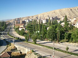
Darende is located in Malatya district. Darende was a centre of science and culture, during the ancient silk road times. The city centre is situated on the East Anatolia Region where there is a statue of a big door that was the entrance of the city Malatya. The largest district of Malatya is Darende. Darende is located in the west of the city also placed on the trade route that is on the upper part of Euphrate (Firat) and on the valley of Tohma where ancient caravans passed. The district, placed on the road between Ankara and Istanbul have as borders Hekimhan on the South of Akçadağ, on the southern west part of Gürün, and North of Kuluncak and Kangal. It has 1540m2 area. Its height above sea level is 1006 m. Satellite view of Darende.
Darende has a long history, being in the centre of different civilizationes. Until 1914 the population of Darende was quite diverse, the city had an Armenian population of 3,983, with 3 Armenian churches and schools, which had about 300 pupils. After the events of 1915 only a small minority of Armenians stayed, those who stayed secretly changed the names for Islamic names to avoid further repression. Since the founding of modern Turkey, Darende has grown in population. The surrounding geography includes the Tohma River flows in Darende abundantly. In 1934, it was one of the districts of Sivas, but because of cultural, climatic and regional similarities, Darende became one of the districts of Malatya. The city sustained its popularity in the First period of Turkish Republic.
Balaban, Aşaği Ulupinar, Yenice, Ayvali, Ilica and Ağilbaşi towns, and there are 44 villages in Darende. It was called as Timelkie, Tiranda, Tiryandafil and Derindere in history and at present it is called Darende. The Zengibar Castle is the symbol of the district. It is one of the interesting castles of Turkey that is built on rocks. The castle was built during the Hittite and Urartu civilizations. The castle has an entrance gate, the King’s house and graves remnants. There are three graves of Sahabe and they are on the field of “HU DEDE” which is on the slopes of castle. Darende had been conquered by Halid Bin Velid whose army hadn’t been defeated in any time and since then it has been centre of belief and culture. Seyyid Abdurrahman Gazi had been martyred on this land while he was a soldier of Holy Army fighting for the Conquest of Istanbul.
...
Wikipedia

