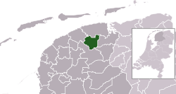
Dantumadeel
|
Dantumadiel Dantumadeel |
|||
|---|---|---|---|
| Municipality | |||

Medieval church of Rinsumageast
|
|||
|
|||
 Location in Friesland |
|||
| Coordinates: 53°17′N 6°0′E / 53.283°N 6.000°ECoordinates: 53°17′N 6°0′E / 53.283°N 6.000°E | |||
| Country | Netherlands | ||
| Province | Friesland | ||
| Government | |||
| • Body | Municipal council | ||
| • Mayor | Arie Aalberts (CDA) | ||
| Area | |||
| • Total | 87.53 km2 (33.80 sq mi) | ||
| • Land | 85.41 km2 (32.98 sq mi) | ||
| • Water | 2.12 km2 (0.82 sq mi) | ||
| Elevation | 2 m (7 ft) | ||
| Population (February 2017) | |||
| • Total | 19,017 | ||
| • Density | 223/km2 (580/sq mi) | ||
| Time zone | CET (UTC+1) | ||
| • Summer (DST) | CEST (UTC+2) | ||
| Postcode | 9067, 9100–9114, 9269–9272 | ||
| Area code | 0511, 0519, 058 | ||
| Website | www |
||
Dantumadiel (West Frisian, official since January 1, 2009, Dutch: Dantumadeel (![]() pronunciation )) is a municipality in the province of Friesland (Fryslân) in the Netherlands. Dantumadiel is a rural municipality characterized by agriculture.
pronunciation )) is a municipality in the province of Friesland (Fryslân) in the Netherlands. Dantumadiel is a rural municipality characterized by agriculture.
The first time Dantumadiel is mentioned was in a document from 1242. In that time Dantumadiel, or Donthmadeil as it was then known, was a part of the Winninghe district, the northern part of Oostergo. The grietenij (municipality) Dantumadiel was led by a grietman (mayor) who was holding office in Rinsumageast and Dantumawâld. The Dutch Municipalities Act of 1851 (Dutch: Gemeentewet van 1851) abolished the grietenijen, which automatically became gemeenten (municipalities) headed by a mayor.[1]
The Dantumadiel municipality is composed of 11 towns with a total of 19,030 inhabitants in 2014; the towns and their 2014 populations are listed in the table.
Source: Website Dantumadiel municipality
* Including Feanwâldsterwâl (Veenwoudsterwal)
De Grote Molen, Broeksterwoude, build in 1887
The Skierstins
The Dantumadiel municipal government consists of a municipal council, board of aldermen and the mayor. Arie Aalberts (CDA) is the mayor of Dantumadiel since September 2004.
...
Wikipedia


