Dalaguete
| Dalaguete | |
|---|---|
| Municipality | |

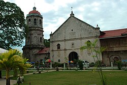
St William of Aquitaine church
|
|
 Map of Cebu with Dalaguete highlighted |
|
| Location within the Philippines | |
| Coordinates: 9°46′N 123°32′E / 9.77°N 123.53°ECoordinates: 9°46′N 123°32′E / 9.77°N 123.53°E | |
| Country | Philippines |
| Region | Central Visayas (Region VII) |
| Province | Cebu |
| District | 2nd district of Cebu |
| Barangay | 33 (see § Barangays) |
| Government | |
| • Type | Sangguniang Bayan |
| • Mayor | Ronald Cesante (LP) |
| • Vice mayor | Jeffrey Belciña |
| • Town Council |
Members
|
| • Representative | Wilfredo Caminero |
| Area | |
| • Total | 154.96 km2 (59.83 sq mi) |
| Elevation | 1,013 m (3,323 ft) |
| Population (2015 census) | |
| • Total | 67,497 |
| • Density | 440/km2 (1,100/sq mi) |
| • Voter (2016) | 35,658 |
| Demonym(s) | Dalaguetenon Dalaguitnon |
| Time zone | PHT (UTC+8) |
| ZIP code | 6022 |
| IDD : area code | +63 (0)32 |
| Income class | 1st class |
| PSGC | 072222000 |
| Website | dalaguete |
Dalaguete is a 1st municipal income class municipality in the province of Cebu, Philippines, located 84 kilometres (52 mi) south of Cebu city. It is bounded on the north by Argao, on the south by Alcoy, on the west by the municipalities of Badian and Alegria and on the east by the Bohol Strait. According to the 2015 census, it has a population of 67,497. In the 2016 electoral roll, it had 35,658 registered voters. Dalaguete one of the trails to Cebu's highest summit, the Osmeña Peak.
The natives look upon the tree not for its gigantic size, nor for its fruit which is of no use, but rather for the religious observance of the natives.
They highly consider this tree for their belief that it harbors spirits or diwatas who could impose sickness if maltreated or hand in fortunes and gifts if placated. When fully grown, the intertwining roots are exposed from the earth and form huge caverns that could house several people.
The dalakit (Ficus benjamina) tree is the foundation of the origin and name of Dalaguete. In ancient times, before the coming of the Spaniards, these trees had been used by people as major landmarks. People gathered under the encompassing shades and conduct social and economic activities such us festivities, contest, trading meetings and other community gatherings. They establish market places under the shades of the dalaket where they sell their products and conduct trade with local roving traders bringing in Chinese and Asiatic goods from the port of Cebu.
The place where the church or the poblacion were laid would have been the site of a communal gathering area for the natives. It was also the abode of a huge dalaket tree which provide shade and shelter while people conduct their activities. "Adto ta mag-abot sa dalakit". "Adto ta magtigom-tigom sa dalakit" [Let us meet at the dalakit]. These and other popular phrases have the common practice of our ancestors when coming up with an agreement to meet or conduct an activity specifically at the site where the dalakit is situated. For several generations in pre-Hispanic Dalaguete, the area has always been unofficially called as dalakit. Its accessibility and its reputation as a communal area for community gathering have prompted the Spanish authorities to construct the church and eventually establish the area as part of an encomienda. From this common ground, and from this tree, begun the conception of a larger town which later come to be known as Dalaguete.
...
Wikipedia

