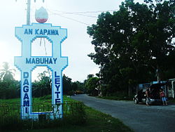
Dagami
| Dagami | ||
|---|---|---|
| Municipality | ||
 |
||
|
||
 Dagami's location on the map of Leyte |
||
| Location within the Philippines | ||
| Coordinates: 11°03′40″N 124°54′11″E / 11.06111°N 124.90306°ECoordinates: 11°03′40″N 124°54′11″E / 11.06111°N 124.90306°E | ||
| Country |
|
|
| Region | Eastern Visayas (Region VIII) | |
| Province | Leyte | |
| District | 2nd District of Leyte | |
| Founded | 1565 | |
| Barangays | 65 | |
| Government | ||
| • Mayor | Deo Delusa | |
| • Vice Mayor | Antonio C. Diaz | |
| Area | ||
| • Total | 161.65 km2 (62.41 sq mi) | |
| Population (2015 census) | ||
| • Total | 35,147 | |
| • Density | 220/km2 (560/sq mi) | |
| Time zone | PST (UTC+8) | |
| ZIP code | 6515 | |
| Dialing code | +63 (0)53 | |
| Income class | 3rd municipal income class | |
| 083717000 | ||
| Electorate | 22,132 voters as of 2016 | |
| Website | www |
|
Dagami is a 3rd class municipality in the province of Leyte, Philippines. According to the 2015 census, it has a population of 35,147 people with a density of 188 persons per square kilometer. Waray-Waray is the language spoken by the residents called Dagamin-on.
It is classified as a third class municipality and mere dependent on agriculture such as coconut, rice and corn farming. The employment rate is 63% of the total population workforce in the municipality. Its total land area of 161.5 square kilometers, equivalent to 16,165 hectares. More than half of its plains on the eastern side is cultivated for rice and corn farming while the western side is planted with coconut with the westernmost area as forestland. Coconut is a major source of income form Paml wine and copra - the raw material for production of coconut oil.
The town of Dagami is famous for its local delicacies called "Binagol" (made with sweetened mashed giant taro called talian and packed in half of a leaf-covered coconut shell), "Moron" (sweetened sticky rice stick with peanuts and chocolate) and "Sagmani".
According to legend, the island of Leyte was once divided into kingdoms or sultanates:
In 1478, two hundred years after the three sultanates unite into one kingdom, changes took place. Its capital, Dagilan, increased in population. The culture and social life of the kingdom further evolved with the entry of the Chinese and the Hindus. The people engaged in trade both with Asia and Europe.
When the Spanish conquistadors arrived in Leyte in 1521, trade mostly took place in the villages bordering the sea, where Dagilan was located.
Locals indicate the name "Dagami" first arose during a confrontation between a group of Spaniards and a group of farmers during the Spanish colonial period:
In 1957, the barrios of Capahu-an and Guingawan were transferred to the town of Tabontabon, which used to be a barangay of Dagami.
...
Wikipedia


