Cypress Hills (Canada)
| Cypress Hills | |
|---|---|

The Cypress Hills
|
|
| Highest point | |
| Elevation | 1,468 m (4,816 ft) |
| Coordinates | 49°37′48″N 110°21′34″W / 49.63000°N 110.35944°WCoordinates: 49°37′48″N 110°21′34″W / 49.63000°N 110.35944°W |
| Geography | |
|
|
|
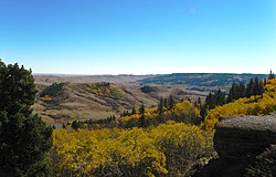
The Cypress Hills are a geographical region of hills in southwestern Saskatchewan and southeastern Alberta, Canada.
The highest point in the Cypress Hills is at Head of the Mountain in Alberta at 1,466 metres (4,810 ft). The highest point in Saskatchewan is at 1,392 m (4,567 ft). Its location is at 49°33′N 109°59′W / 49.550°N 109.983°W.
The Cypress Hills have been known by a wide number of native and European names throughout their history. An 1882 Blackfoot–English dictionary written by C. M. Lanning provided the Blackfoot name I-kim-e-kooy, which translates as "striped earth" or "earth over earth". The Cree name, in use at the same time, was Manâtakâw, (spelled in a variety of anglicized forms including "Mun-a-tuh-gow"), sometimes said to mean "beautiful upland" but more accurately referring to "an area to be respected, protected, taken care of and/or taken care with". The Assiniboine name is wazíȟe . Early Métis hunters, who spoke a variation of French, called the hills les montagnes des Cyprès, in reference to the abundance of jack pine trees. In the Canadian French spoken by the Métis, the jack pine is called cyprès, although it is not a true cypress tree. The English translation is Cypress Hills.
...
Wikipedia

