Cutral Có Airport
|
Cutral Có Airport Aeropuerto de Cutral Có |
|||||||||||||||
|---|---|---|---|---|---|---|---|---|---|---|---|---|---|---|---|
| Summary | |||||||||||||||
| Airport type | Public | ||||||||||||||
| Serves | Cutral Có | ||||||||||||||
| Elevation AMSL | 650 ft / 2,133 m | ||||||||||||||
| Coordinates | 38°56′23″S 69°15′53″W / 38.93972°S 69.26472°WCoordinates: 38°56′23″S 69°15′53″W / 38.93972°S 69.26472°W | ||||||||||||||
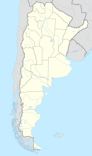
| Map | |||||||||||||||
| Location in Argentina | |||||||||||||||
| Runways | |||||||||||||||
|
|||||||||||||||
|
Sources: World Aero Data
|
|||||||||||||||
Cutral Có Airport (IATA: CUT, ICAO: SAZW) is an airport serving Cutral Có, Neuquén province, Argentina. The airport covers and area of 260 hectares (640 acres), and has a 400-square-metre (4,300 sq ft) covered terminal.
...
Wikipedia

