Cutler Ridge
| Cutler Bay, Florida | ||
|---|---|---|
| Town | ||
| Town of Cutler Bay | ||
|
||
| Motto: "An Excellent Place To Live. Work. Play." | ||
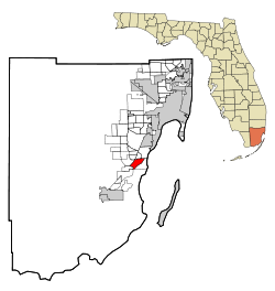
 Location in Miami-Dade County and the state of Florida |
||
 U.S. Census Bureau map showing town boundaries |
||
| Coordinates: 25°34′57″N 80°20′48″W / 25.58250°N 80.34667°W | ||
| Country | ||
| State |
|
|
| County |
|
|
| Incorporated | November 9, 2005 | |
| Government | ||
| • Type | Council-Manager | |
| • Mayor | Peggy Bell | |
| • Vice Mayor | Sue Loyzelle | |
| • Councilmembers | Mary Ann Mixon, Michael Callahan, and Roger Coriat | |
| • Town Manager | Rafael G. Casals | |
| • Town Clerk | Debra Eastman | |
| Area | ||
| • Total | 10.23 sq mi (26.49 km2) | |
| • Land | 9.83 sq mi (25.45 km2) | |
| • Water | 0.40 sq mi (1.03 km2) | |
| Population (2010) | ||
| • Total | 40,286 | |
| • Estimate (2016) | 44,707 | |
| • Density | 4,548.94/sq mi (1,756.36/km2) | |
| Time zone | EST (UTC-5) | |
| • Summer (DST) | EDT (UTC-4) | |
| Zip Codes | 33157, 33189 | |
| Area code(s) | 305, 786 | |
| FIPS code | 12-15968 | |
| Website | http://www.cutlerbay-fl.gov/ | |
Cutler Bay is an incorporated town in Miami-Dade County, Florida established in 2005, with a population of approximately 44,700 as of 2016.
The borders were established as running from SW 184th Street (Eureka Dr) east of US 1 to the coast, and north of Black Point Marina, at 25°34′50″N 80°20′48″W / 25.58056°N 80.34667°W. The town's boundaries include the northeast section of Biscayne National Park, areas formerly known as Cutler Ridge to the west, as well as the neighborhood and former CDP of Lakes by the Bay to the east.
In August 1992, Hurricane Andrew made landfall near the area and caused extensive destruction. Lakes by the Bay was one of the areas of Miami most affected by Hurricane Andrew, and most homes and businesses in the area were completely destroyed. The area has since been rebuilt.
Cutler Bay is located just west of Biscayne Bay at 25°34′58″N 80°20′48″W / 25.582684°N 80.346799°WCoordinates: 25°34′58″N 80°20′48″W / 25.582684°N 80.346799°W.
...
Wikipedia

