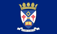
Currie
Currie
|
|
|---|---|
 The Flag of Currie |
|
 The Coat of Arms of Currie |
|
| Currie shown within Edinburgh | |
| Population | 8,550 (2001) |
| OS grid reference | NT182677 |
| Civil parish |
|
| Council area | |
| Country | Scotland |
| Sovereign state | United Kingdom |
| Post town | CURRIE |
| Postcode district | EH14 |
| Dialling code | 0131 |
| Police | Scottish |
| Fire | Scottish |
| Ambulance | Scottish |
| EU Parliament | Scotland |
| UK Parliament | |
| Scottish Parliament | |
Currie (Scottish Gaelic: Currach) is a suburb of Edinburgh, Scotland, situated 7 miles south west of the city centre. A former village within the County of Midlothian, it lies to the south west of the city, between Juniper Green (NE) and Balerno (SW) on the Lanark Road. Administratively, Currie falls within the jurisdiction of the City of Edinburgh Council. It gives its name to a civil parish.
In 2001 the population of Currie was 8,550 and it contained 3,454 houses.
There is no accepted derivation of the name Currie but it is possibly from the Scottish Gaelic word curagh/curragh, a wet or boggy plain, or from the Brythonic word curi, a dell or hollow. The neighbouring suburb of Balerno derives its name from Scottish Gaelic, whilst the nearby Pentland Hills derive their name from Brythonic, so either is possible.
The earliest record of a settlement in the Currie area is a Bronze Age razor (1800 BC) found at Kinleith Mill and the stone cists (500 BC) at Duncan's Belt and Blinkbonny. There are a few mentions of this area in mediaeval and early modern documents. One of the first is when Robert of Kildeleith became Chancellor of Scotland in 1249. Kildeleith means Chapel by the Leith, and survives today as Kinleith. Robert the Bruce gave Riccarton as a wedding present in 1315 and in 1392 the land passed to the family of Bishop Wardlaw. In 1612 the land went to Ludovic Craig, a Senator of the College of Justice. In 1818 it passed to the female line and became the property of the Gibson-Craigs.
...
Wikipedia

