Curacaví
| Curacaví | ||||
|---|---|---|---|---|
| City and Commune | ||||
|
||||
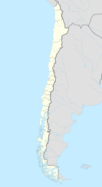
| Coordinates: 33°24′S 71°09′W / 33.400°S 71.150°WCoordinates: 33°24′S 71°09′W / 33.400°S 71.150°W | ||||
| Country | Chile | |||
| Region | Santiago Metropolitan Region | |||
| Province | Melipilla Province | |||
| Government | ||||
| • Type | Municipality | |||
| • Alcalde | Juan Pablo Barros Basso (IND) | |||
| Area | ||||
| • Total | 693.2 km2 (267.6 sq mi) | |||
| Population (2002 Census) | ||||
| • Total | 24,298 | |||
| • Density | 35/km2 (91/sq mi) | |||
| • Urban | 15,645 | |||
| • Rural | 8,653 | |||
| Sex | ||||
| • Men | 12,351 | |||
| • Women | 11,947 | |||
| Time zone | CLT (UTC-4) | |||
| • Summer (DST) | CLST (UTC-3) | |||
| Area code(s) | 56 + | |||
| Website | Municipality of Curacaví | |||
Curacaví (Spanish pronunciation: [ku.ɾa.ka.ˈβi]) is a city and commune in the Melipilla Province of central Chile's Santiago Metropolitan Region. Its climate is temperate Mediterranean with a long dry season, experiencing high temperatures in summer and low temperatures in winter. Curacavi is located on the Ruta 68 between the coastal conurbation of Vina del mar and Valparaiso and Santiago which has proved a popular home for expats working in Santiago.
Curacaví is a commune situated between the hills of the coastal mountain range in central Chile, located in the Metropolitan Region of Santiago, specifically in Melipilla Province, with an area of 693 km² and borders the following municipalities: Casablanca, Quilpué, Lampa, Pudahuel, Maipú, Padre Hurtado, Melipilla, and Maria Pinto.
Curacavi is integrated along with the communes of Talagante, Melipilla, Peñaflor, Isla de Maipo, Maria Pinto, El Monte, San Pedro and Alhué in the number 31 Electoral District and also belongs to the 7th Chilean Senate District (Santiago west). The commune covers five districts: Curacaví, Bustamante, Lo Prado, Zapata and Caren.
...
Wikipedia


