Lo Prado
| Lo Prado | ||||||
|---|---|---|---|---|---|---|
| City and Commune | ||||||
|
||||||
| Coordinates (city): 33°27′S 70°43.5′W / 33.450°S 70.7250°WCoordinates: 33°27′S 70°43.5′W / 33.450°S 70.7250°W | ||||||
| Country | Chile | |||||
| Region | Santiago Metro. | |||||
| Province | Santiago | |||||
| Government | ||||||
| • Type | Municipality | |||||
| • Alcalde | Gonzalo Navarrete Muñoz (PPD) | |||||
| Area | ||||||
| • Total | 6.7 km2 (2.6 sq mi) | |||||
| Population (2002 Census) | ||||||
| • Total | 104,316 | |||||
| • Density | 16,000/km2 (40,000/sq mi) | |||||
| • Urban | 104,316 | |||||
| • Rural | 0 | |||||
| Sex | ||||||
| • Men | 50,608 | |||||
| • Women | 53,708 | |||||
| Time zone | CLT (UTC-4) | |||||
| • Summer (DST) | CLST (UTC-3) | |||||
| Area code(s) | 56 + | |||||
| Website | Municipality of Lo Prado | |||||
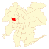
Lo Prado (Spanish pronunciation: [lo ˈpɾaðo]) is one of the poorest communes of Chile located in Santiago Province, Santiago Metropolitan Region.
According to the 2002 census of the National Statistics Institute, Lo Prado spans an area of 6.7 km2 (3 sq mi) and has 104,316 inhabitants (50,608 men and 53,708 women), making the commune an entirely urban area. The population fell by 6% (6617 persons) between the 1992 and 2002 censuses. Its 2006 projected population was 98,983.
As a commune, Lo Prado is a third-level administrative division of Chile administered by a municipal council, headed by an alcalde who is directly elected every four years. The 2012-2016 alcalde is Gonzalo Navarrete Muñoz (PPD). The communal council has the following members:
Within the electoral divisions of Chile, Lo Prado is represented in the Chamber of Deputies by Nicolás Monckeberg (RN) and Cristina Girardi (PPD) as part of the 18th electoral district, (together with Cerro Navia and Quinta Normal). The commune is represented in the Senate by Guido Girardi Lavín (PPD) and Jovino Novoa Vásquez (UDI) as part of the 7th senatorial constituency (Santiago-West).
...
Wikipedia


