Crynant
Crynant
|
|
|---|---|
 The Square, Crynant |
|
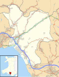
| Crynant shown within Neath Port Talbot | |
| Population | 1,910 (2011) |
| OS grid reference | SN793047 |
| Principal area | |
| Ceremonial county | |
| Country | Wales |
| Sovereign state | United Kingdom |
| Post town | NEATH |
| Postcode district | SA10 |
| Dialling code | 01639 |
| Police | South Wales |
| Fire | Mid and West Wales |
| Ambulance | Welsh |
| EU Parliament | Wales |
| UK Parliament | |
Crynant (or Welsh: Y Creunant) is a village in the Dulais Valley in Wales. It lies 7¾ miles north-east from the town of Neath in Neath Port Talbot, lying between the mountains of Mynydd Marchywel to the west, Hirfynydd to the east and Mynydd y Drum to the north.
Crynant is a long village, lying on the narrow valley floor and lower slopes of Hirfynydd. Originally there were separate villages (essentially separate farms), such as the region of Treforgan, but all have now merged into a single village. The River Dulais flows through the village.
Creunant is also the name of an electoral ward and a community, coterminous with the village, in Neath Port Talbot County Borough.
The name Y Creunant has its etymology, like many Welsh place names, in description. 'Creu' (or nghreu) meaning the creation, or beginning, and 'nant' meaning stream or brook. A different interpretation of the prefix is 'crai', implying a narrow place signifying a brook that has to make its way through a narrow place. Another explanation states that the place name is a contraction of Croyw-nant, the clear brook. Creu also means a pound, as in an animal pound by the stream, a pound was known to have been sited on ground opposite the Red Lion public house at the town square.
In the Middle Ages, there was a small monastic cell in Crynant where monks and other pilgrims would break their journeys. The village first appeared on maps as Capel Creunant (Creunant Chapel) which may have referred to the monastic outpost. Crynant remained a rural agricultural community of scattered farms until the 19th century, and the discovery of coal.
...
Wikipedia

