Cruces, Cuba
| Cruces | |
|---|---|
| Municipality | |

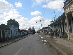
The state road crossing the north of Cruces
|
|
 Cruces municipality (red) within Cienfuegos Province (yellow) and Cuba |
|
| Location of Cruces in Cuba | |
| Coordinates: 22°20′31″N 80°16′34″W / 22.34194°N 80.27611°WCoordinates: 22°20′31″N 80°16′34″W / 22.34194°N 80.27611°W | |
| Country |
|
| Province | Cienfuegos |
| Founded | 1852 |
| Area | |
| • Total | 198 km2 (76 sq mi) |
| Elevation | 95 m (312 ft) |
| Population (2004) | |
| • Total | 32,139 |
| • Density | 162.3/km2 (420/sq mi) |
| Time zone | EST (UTC-5) |
| Area code(s) | +53-432 |
Cruces (Spanish pronunciation: [ˈkɾuses]) is a municipality and town in Cienfuegos Province, Cuba. It is the home of the Mal Tiempo National Park which commemorates a battle in the 1895 War of Independence.
The town was founded in 1852 in a place known as Sabana de Ibarra. The construction of a railway between Cienfugos Province and Villa Clara began in 1848, causing an economic boom and the expansion of the town. The railway reached the town in 1855.There were 5 sugar mills in the vicinity of Cruces, known by the traditional names San Francisco, Andreita, Santa Catalina, Caracas and Hormiguero.
The town is noted for the Battle of Bad Weather (La Batalla de Mal Tiempo), in which Cuban rebels (Mambises) fought Spanish colonialists during the Cuban War of Independence. On December 15, 1895, Cuban rebels engaged Spanish troops near the town of Cruces in the sugar fields of the Mal Tiempo (Bad Weather) sugar mill, setting fire to the sugarcane fields and charging the Spanish with machetes. The Cuban Liberation Army reported four of their own dead and as many wounded, while claiming to have inflicted "about 200" casualties on the enemy. The Cuban forces also captured 150 Mauser and 60 Remington rifles, 6 boxes of ammunition, horses, mules, first aid supplies, and the flags and documents of the Spanish forces.
In 1909, a monument was commissioned to mark the location of the mass grave of Spanish and Cuban casualties of the Battle of Bad Weather. As part of the construction of the monument, the Spanish and Cuban casualties were to be exhumed, identified, and later re-buried. The bodies of 79 Spaniards and 7 Cubans were exhumed, with the bodies re-interred within the base of the monument, visible through a glass viewing portal on the monument itself.
The monument was completed in 1910, with a park constructed around the monument in 1950. In 1963, the monument was destroyed, but was reconstructed "as closely as possible to the original" in 1965. The monument was declared a National Monument in October 1978, along with four other monuments within the provence of Cienfuegos. The glass viewing portal was replaced with an opaque marble cover in preparation for becoming a National Monument.
...
Wikipedia

