Croydon Park, South Australia
|
Croydon Park Adelaide, South Australia |
|||||||||||||
|---|---|---|---|---|---|---|---|---|---|---|---|---|---|

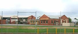
St Margaret Mary's Primary School on Torrens Road
|
|||||||||||||
| Population | 4,000 (approx.) | ||||||||||||
| Postcode(s) | 5008 | ||||||||||||
| LGA(s) | City of Port Adelaide Enfield | ||||||||||||
| State electorate(s) | Croydon | ||||||||||||
| Federal Division(s) | Adelaide | ||||||||||||
|
|||||||||||||
Croydon Park is a north-western suburb of Adelaide 7 km from the CBD, in the state of South Australia, Australia and is within the City of Port Adelaide Enfield. It is adjacent to Dudley Park, Devon Park, Renown Park, Regency Park, Ferryden Park Kilkenny, and West Croydon. The post code for Croydon Park is 5008. It is bounded to the south by Lamont Street and Torrens Road, to the north by Regency Road and in the east and west by Harrison Road and Goodall Avenue respectively. Croydon Park is predominantly a residential suburb, with a warehousing presence on the northern edges near Regency Road.
The suburb is not served by a public primary school. Croydon Park Primary School was closed at the end of 1997 due to declining enrolments. The former site at Hudson Avenue was later developed into housing. The closest primary schools are Challa Gardens Primary School, to the west in Kilkenny, or Brompton Primary School in Brompton. However, St. Margaret Mary's, a Catholic primary school operates within the suburb. The local high school was Croydon High School (closed 2007), in adjacent West Croydon. The Douglas Mawson Institute of TAFE is located on the western end of the suburb. Polonia Reserve, the base of State League football (soccer) team Croydon Kings is located on the eastern side of Croydon Park.
...
Wikipedia
