Croydon, Victoria
|
Croydon Melbourne, Victoria |
|||||||||||||
|---|---|---|---|---|---|---|---|---|---|---|---|---|---|

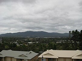
View of Croydon and Mount Dandenong
|
|||||||||||||
| Coordinates | 37°47′46″S 145°16′52″E / 37.796°S 145.281°ECoordinates: 37°47′46″S 145°16′52″E / 37.796°S 145.281°E | ||||||||||||
| Population | 23,553 (2011) | ||||||||||||
| • Density | 1,647/km2 (4,266/sq mi) | ||||||||||||
| Postcode(s) | 3136 | ||||||||||||
| Area | 14.3 km2 (5.5 sq mi) | ||||||||||||
| Location | 27 km (17 mi) from Melbourne | ||||||||||||
| LGA(s) | City of Maroondah | ||||||||||||
| State electorate(s) | Croydon | ||||||||||||
| Federal Division(s) | |||||||||||||
|
|||||||||||||
Croydon is a suburb of Melbourne, Victoria, Australia, 27 km east of Melbourne's Central Business District. Its local government area is the City of Maroondah. At the 2011 Census, Croydon had a population of 23,553.
Dating back to 1840 the land was first utilised by settlers for grazing and the first road cut through the area now known as Croydon, was initially known as Sawmill Road, as a sawmill was nearby. Later it became known as Oxford Road and later Mt Dandenong Road, some time in the early 1900s.
Owing to the coarse silvery-white grass, the area now known as Croydon was first called "White Flats". The Lacey family from Essex, England named the area Croydon after Mrs Lacey's home town. They preferred this to Mr Lacey's home town, Steeple Bumpstead. The Lacey family has a street named after them near the Main St. shopping precinct.
In 1868 parcels of land were surveyed and the first habitations were constructed with wattle and daub. These were later rebuilt in timber and the area prospered in sheep, beef and dairy farming, and sawmills. Orchards were soon established and thrived. Crops included apples, cherries, pears, peaches and plums. Street names in and around Croydon now reflect the impact orchards had on "White Flats".
In 1874 Cobb & Co. ran horses and carts to the area, also known as Brushy Creek.
In 1882 a single rail track was constructed through to Lilydale. When opened on 1 December 1882 the station was called Warrandyte. Travellers would travel by rail to "Warrandyte" station and were then faced with a horse and coach ride to Warrandyte, some 10 km north, which was not well received by the vast majority of travellers, believing the Yarra River was close by. On 1 August 1884 it was renamed Croydon railway station.
From the mid-1880s Croydon started to develop and Mr James Hewish built his home and several other business ventures, including a general store, news agency, butchers shop and hotel, and planted various orchard trees. The Post Office opened on 1 December 1883 after the railway line was established. Nelson's Hill Post Office opened nearby in 1902 and was renamed Burnt Bridge in 1979.
...
Wikipedia

