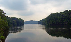
Cross River Reservoir
| Cross River Reservoir | |
|---|---|

East end of the reservoir
|
|
| Location | Westchester County, New York |
| Coordinates | 41°15′15″N 73°37′58″W / 41.2543°N 73.6329°WCoordinates: 41°15′15″N 73°37′58″W / 41.2543°N 73.6329°W |
| Type | reservoir |
| Primary inflows | Cross River |
| Primary outflows | Cross River |
| Catchment area | 30 sq mi (78 km2) |
| Basin countries | United States |
| Max. length | 3.2 mi (5.1 km) |
| Average depth | 36 ft (11 m) |
| Max. depth | 120 ft (37 m) |
The Cross River Reservoir is a reservoir located in northern Westchester County, New York and is part of New York City's water supply system. It is situated within the towns of Bedford, Lewisboro, and Pound Ridge, about 1 mile (1.6 km) east of the village of Katonah, and over 25 mi (40 km) north of New York City. It was constructed around the start of the 20th century by impounding the Cross River, a tributary of the Croton River, which eventually flows into the Hudson River.
The reservoir was finally put into service in 1908. The resulting body of water is one of 16 (12 reservoirs and 4 controlled lakes) in the Croton Watershed, the southernmost of New York City's watersheds. The reservoir is approximately 3.2 mi (5.1 km) long, has a drainage basin of 30 square miles (78 km²), and can hold 10.3 billion US gallons (39,000,000 m3) of water at full capacity, making it one of the city's smaller reservoirs.
To reach the city, water flows through Cross River into the Muscoot Reservoir, then down that one into the New Croton Reservoir, where it enters the New Croton Aqueduct in Yorktown. Via the aqueduct, it flows into The Bronx, entering the Jerome Park Reservoir. In Manhattan, it meets the Catskill Aqueduct. It finally flows through Brooklyn and Staten Island, stopping near the end of the island.
...
Wikipedia
