Crestview Hills, Kentucky
| Crestview Hills, Kentucky | |
|---|---|
| City | |
| Motto: "A great place to call home!" | |
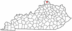
 Location of Crestview Hills, Kentucky |
|
| Coordinates: 39°1′35″N 84°34′0″W / 39.02639°N 84.56667°WCoordinates: 39°1′35″N 84°34′0″W / 39.02639°N 84.56667°W | |
| Country | United States |
| State | Kentucky |
| County | Kenton |
| Area | |
| • Total | 1.9 sq mi (5.0 km2) |
| • Land | 1.9 sq mi (5.0 km2) |
| • Water | 0.0 sq mi (0.0 km2) |
| Elevation | 860 ft (262 m) |
| Population (2010) | |
| • Total | 3,148 |
| • Density | 1,503.1/sq mi (580.4/km2) |
| Time zone | Eastern (EST) (UTC-5) |
| • Summer (DST) | EDT (UTC-4) |
| ZIP code | 41017 |
| Area code(s) | 859 |
| FIPS code | 21-18442 |
| GNIS feature ID | 0490332 |
| Website | crestviewhills.com |
Crestview Hills is a home rule-class city in Kenton County, Kentucky, in the United States. The population was 3,148 at the 2010 census.
Crestview Hills is located in Greater Cincinnati, close to I- 275, Interstate 71, and Interstate 75. It is home to the Crestview Hills Town Center, the Summit Hills Country Club, Five Seasons Country Club, and Thomas More College. It is also close to St. Elizabeth Hospital, which has many offices in Crestview Hills' Thomas More Research Park. In addition, the 2 ft (610 mm) narrow gaugeRichwood Tahoe Railroad, operating as a venue for charitable organizations, runs Kentucky's only working steam locomotive.
Crestview Hills is located at 39°1′35″N 84°34′0″W / 39.02639°N 84.56667°W (39.026398, -84.566543). According to the United States Census Bureau, the city has a total area of 1.9 square miles (4.9 km2), all land. Its neighborhoods include: Lookout Farm, Old Crestview, College Park, Summit Lakes, and Grandview Summit.
The City of Crestview Hills is governed by a mayor and six city council members. Additionally, the City of Crestview Hills is staffed by a City Administrator, Finance Officer/Treasurer, City Attorney, City Clerk, and City Engineer. Elections for council members are held every even numbered year and the mayor is elected every four years.
...
Wikipedia
