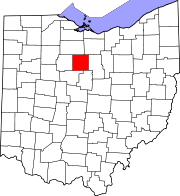
Crawford County, Ohio
| Crawford County, Ohio | ||
|---|---|---|

|
||
|
||
 Location in the U.S. state of Ohio |
||
 Ohio's location in the U.S. |
||
| Founded | April 1, 1826 | |
| Named for | Colonel William Crawford | |
| Seat | Bucyrus | |
| Largest city | Bucyrus | |
| Area | ||
| • Total | 403 sq mi (1,044 km2) | |
| • Land | 402 sq mi (1,041 km2) | |
| • Water | 0.9 sq mi (2 km2), 0.2% | |
| Population | ||
| • (2010) | 43,784 | |
| • Density | 109/sq mi (42/km²) | |
| Congressional district | 4th | |
| Time zone | Eastern: UTC-5/-4 | |
| Website | www |
|
Crawford County is a county located in the U.S. state of Ohio. As of the 2010 census, the population was 43,784. The approximate population as of 2014 is 42,480, causing a -3.00% change over the past 4 years, according to the United States Census Bureau. Its county seat is Bucyrus. The county was created in 1820 and later organized in 1836. It was named for Colonel William Crawford, a soldier during the American Revolution.
Crawford County comprises the Bucyrus, OH Micropolitan Statistical Area, which is also included in the Mansfield-Ashland-Bucyrus, OH Combined Statistical Area.
According to the U.S. Census Bureau, the county has a total area of 403 square miles (1,040 km2), of which 402 square miles (1,040 km2) is land and 0.9 square miles (2.3 km2) (0.2%) is water. It is the fourth-smallest county in Ohio by total area.
The county is drained by the Sandusky and Olentangy Rivers.
As of the census of 2000, there were 46,966 people, 18,957 households, and 13,175 families residing in the county. The population density was 117 people per square mile (45/km²). There were 20,178 housing units at an average density of 50 per square mile (19/km²). The racial makeup of the county was 97.99% White, 0.59% Black or African American, 0.20% Native American, 0.31% Asian, 0.02% Pacific Islander, 0.24% from other races, and 0.65% from two or more races. 0.77% of the population were Hispanic or Latino of any race. 40.4% were of German, 21.4% American, 8.1% English and 7.8% Irish ancestry according to Census 2000.
...
Wikipedia

