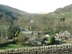
Cragg Vale
| Cragg Vale | |
|---|---|
 |
|
| Cragg Vale shown within West Yorkshire | |
| Population | 650 (2001) |
| OS grid reference | SE005225 |
| Civil parish | |
| Metropolitan borough | |
| Metropolitan county | |
| Region | |
| Country | England |
| Sovereign state | United Kingdom |
| Post town | HEBDEN BRIDGE |
| Postcode district | HX7 |
| Dialling code | 01422 |
| Police | West Yorkshire |
| Fire | West Yorkshire |
| Ambulance | Yorkshire |
| EU Parliament | Yorkshire and the Humber |
| UK Parliament | |
Cragg Vale is a village in Calderdale, West Yorkshire, England, located south of Mytholmroyd on the B6138 road which joins the A58 and the A646. The village is part of Luddendenfoot Ward of Calderdale Council.
There is evidence of human activity on the Yorkshire moors around Cragg from c. 10,000 BC. Flints, not native to West Yorkshire, have been found on Blackstone and Midgley Moors – implying movement of peoples and long distance trade by this period at the latest.
Later flint spear heads and arrow tips, hunting weapons, have been found in quantity over Manshead and Rishworth moors. So we know Mesolithic tribes hunted around both the Turvin and Cragg areas.
Hunters were constrained to move across the high reaches, which were less heavily wooded, rather than the steep sided valleys – but to cross from top to top they must descend to ford the streams and rivers of the valley bottoms.
Although prehistoric and later peoples were responsible for extensive tree felling and land clearance this did not create the peat moors above Cragg Vale.
Around 5000 BC the climate changed and became much wetter and remained so for over 2,000 years. Soil deteriorated as minerals were washed away, and the land around Cragg became waterlogged. The trees and plant life died away and the peat moors on the tops were created.
We know from place naming and language conventions that ancient Britons (the Brigantes tribe), Anglo Saxons, Vikings, and Romans had a large input into the area of Cragg.
The Romans left little except their (disputed) road over Blackstone Edge as evidence – but there would have been extensive forced population relocation as the engineers and troops pushed forwards.
We know the Romans made a pact with the Brigantes tribe, and that this whole area of West Yorkshire – the centre of the ancient kingdom of Elmet – was ruled by them. Little remains of Elmet but the ancient names. Close by Cragg lies the hamlet of Warley, and not much further away to the west lies Walsden – both names relate to the 'Walh' – a term used for the Britons. This implies a residual British culture after the invasion and takeover by the victorious Anglo Saxons
The Britons were annexed by the Romans by 100 AD, and c. 700 AD the Saxons arrived. Around 1000 AD, the Vikings gained control. They in turn were overcome by the Normans by 1100 AD. Leading into the Medieval period
The primary industry was agriculture, but iron was smelted too, good timber and charcoal was produced, and grain was milled. Local craftsmen produce some cloth, make clothing, farm implements, and utensils while others provide transport services and labour.
...
Wikipedia

