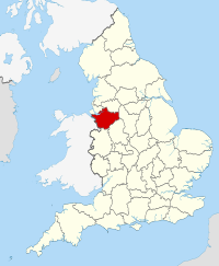
County Palatine of Chester
| Cheshire | |||
|---|---|---|---|
| County | |||
|
|||
 Cheshire in England |
|||
| Coordinates: 53°10′N 2°35′W / 53.167°N 2.583°WCoordinates: 53°10′N 2°35′W / 53.167°N 2.583°W | |||
| Sovereign state |
|
||
| Country |
|
||
| Region | North West | ||
| Established | Ancient | ||
| Ceremonial county | |||
| Lord Lieutenant | Thomas David Briggs | ||
| High Sheriff | Mrs K H Cowell (2016-17) | ||
| Area | 2,343 km2 (905 sq mi) | ||
| • Ranked | 25th of 48 | ||
| Population (mid-2015 est.) | 1,043,500 | ||
| • Ranked | 19th of 48 | ||
| Density | 445/km2 (1,150/sq mi) | ||
| Ethnicity | 97.3% White 1.7% Asian 0.6% Black 0.4% White Other |
||
 Districts of Cheshire All unitary |
|||
| Districts | |||
| Members of Parliament | List of MPs | ||
| Police | Cheshire Constabulary | ||
| Time zone | GMT (UTC) | ||
| • Summer (DST) | BST (UTC+1) | ||
Cheshire (/ˈtʃɛʃər/ or /ˈtʃɛʃɪər/; archaically the County Palatine of Chester; abbreviated Ches.) is a county in North West England, bordering Merseyside and Greater Manchester to the north, Derbyshire to the east, Staffordshire and Shropshire to the south and Wales to the west (bordering Wrexham and Flintshire). Cheshire's county town is Chester; the largest town is Warrington.
Other major towns include Congleton, Crewe, Ellesmere Port, Macclesfield, Northwich, Runcorn, Widnes, Wilmslow, and Winsford. The county covers 905 square miles (2,344 km2) and has a population of around 1 million. It is mostly rural, with a number of small towns and villages supporting the agricultural and other industries which produce Cheshire cheese, salt, chemicals and silk.
...
Wikipedia

