Cottbus-Drewitz Airport
|
Cottbus-Drewitz Airport Flugplatz Cottbus-Drewitz |
|||||||||||||||
|---|---|---|---|---|---|---|---|---|---|---|---|---|---|---|---|
| Summary | |||||||||||||||
| Airport type | Civilian | ||||||||||||||
| Operator | Flughafen Süd- Brandenburg-Cottbus GmbH |
||||||||||||||
| Serves | Cottbus | ||||||||||||||
| Location | Jänschwalde-Drewitz | ||||||||||||||
| Built | 1939 | ||||||||||||||
| Elevation AMSL | 276 ft / 84 m | ||||||||||||||
| Coordinates | 51°53′22″N 14°31′55″E / 51.88944°N 14.53194°ECoordinates: 51°53′22″N 14°31′55″E / 51.88944°N 14.53194°E | ||||||||||||||
| Website | www.flugplatz-drewitz.de | ||||||||||||||
| Map | |||||||||||||||
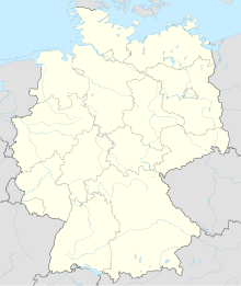
| Location of airport in Germany | |||||||||||||||
| Runways | |||||||||||||||
|
|||||||||||||||
Cottbus-Drewitz Airport (IATA: CBU, ICAO: EDCD) is a civilian airport located in Drewitz, an Ortsteil of Jänschwalde, approximately 25 kilometres (16 mi) north-east of Cottbus in Brandenburg, Germany.
During World War II Cottbus-Drewitz Airport was used by the Luftwaffe and from 1956 by the National People's Army.
Upon German reunification in 1990, the Luftwaffe officially took over the airport once again but after 1993, the airport's new owners, Flughafen Süd-Brandenburg-Cottbus GmbH, had opened it up for civilian use.
In April 2000 a new control tower was opened.
The airport is most often used for charter flights for the football team FC Energie Cottbus, but is also used for training flights by Air Berlin, TUIfly, Lufthansa and Germania.
In late May 2012, a grass strip at the airport was used to conduct unpaved runway trials of the Airbus A400M military airlifter. Although Airbus Military had examined the grass strip and believed it suitable, testing was cut short when the test aircraft penetrated the runway surface during a rejected takeoff test. The test aircraft departed undamaged.
...
Wikipedia

